This special page shows all files uploaded to the English Wikipedia. (See also the list for Wikimedia Commons.) By default, the last uploaded files are shown at top of the list, but clicking on a column header will change the sorting.
Deleted files are not shown here but are included in the upload log.
| Date | Name | Thumbnail | Size | Description |
|---|---|---|---|---|
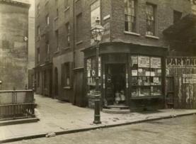
| 20:23, 11 September 2011 | Clare Market slum.jpg ( file) |
 |
11 KB | {{Information |Description = Buildings in New Inn Passage, Houghton Street, London, in what was called the 'Clare Market Slum'. This cluster of narrow, dirty streets lined with butchers' and greengrocers' shops was shortly to be demolished as part of |
| 19:49, 14 August 2011 | Commercial Road booth map.jpg ( file) |
 |
93 KB | {{Information |Description = Poverty map showing Commercial Road from Charles Booth's Labour and Life of the People. Volume 1: East London (London: Macmillan, 1889). The streets are colored to represent the economic class of the reside |
| 16:04, 14 August 2011 | Digital Opportunity.jpg ( file) |
 |
50 KB | {{Information |Description = Cover page of Digital Opportunity – A Review of Intellectual Property and Growth by Prof Ian Hargreaves, May 2011 |Source = http://www.ipo.gov.uk/ipreview.htm |Date = May 2011 |Author |
| 01:16, 15 January 2011 | Mill's logic 1867.jpg ( file) |
 |
71 KB | {{Information |Description = 'Mill's logic' (Punch cartoon) The cartoon mocks John Stuart Mill's attempt to replace the term 'man' with 'person', ie give women the right to vote, in the second Reform Bill of 1867. PRO LIBRARY Punch, p.129 (30 Marc |
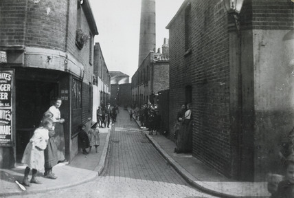
| 17:08, 20 November 2010 | Deptford slum.jpg ( file) |
 |
38 KB | {{Information |Description = A cobbled slum street in a Deptford, London, Circa 1900 |Source = http://www.museumoflondonprints.com/image.php?id=227234&idx=4&fromsearch=true |Date = 1900-1910 |Author = unknown |Permiss |
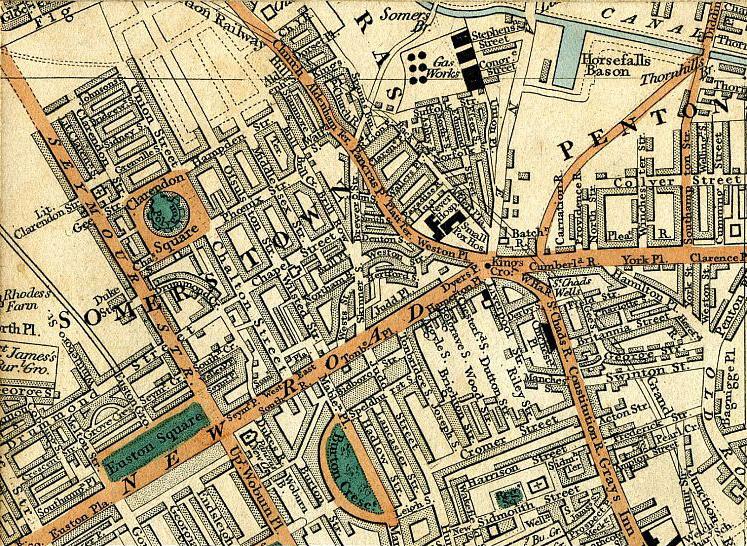
| 20:44, 26 September 2010 | Somers town 1837.jpg ( file) |
 |
208 KB | {{Information |Description = Cary's New Plan Of London And Its Vicinity 1837 - map showing Pancras, Regent's Canal, Clarendon Square, Somers Town, Pentonville, Kings Cross and Euston Square |Source = http://archivemaps.com/mapco/cary1837/cary |
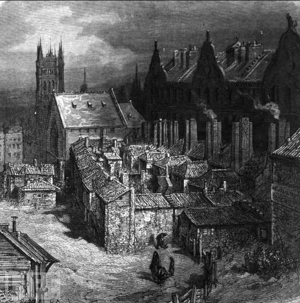
| 22:28, 21 September 2010 | Devils acre.jpg ( file) |
 |
89 KB | {{Information |Description = The slum area known as Devil's Acre in Westminster, London. An illustration by Gustave Dore from 'Dore's London' |Source = http://www.life.com/image/3351725 |Date = 1872 |Author = Gustave Dore |
| 19:09, 6 September 2010 | Copyright Act 1911.jpg ( file) |
 |
60 KB | {{Information |Description = Cover Page of the Copyright Act 1911, also known as the Imperial Copyright Act of 1911 |Source = http://www.opsi.gov.uk/acts/acts1911/pdf/ukpga_19110046_en.pdf |Date = 16 December 1911 |Author |
| 16:39, 15 August 2010 | Music pirates in Canada 1897.png ( file) |
 |
497 KB | {{Information |Description = Article published in The New York Times about copyright infringement in Canada and the USA. "Music Pirates in Canada American Publishers Say They Are Suffering by Copyright Violations There – Steps Taken |
| 21:12, 30 June 2010 | Note to the Poor on Cholera 1848 West Ham.jpg ( file) |
 |
55 KB | {{Information |Description = Notice to the poor on cholera, 1848. From the minutes of the West Ham Board of Guardians |Source = http://apps.newham.gov.uk/History_canningtown/pic20.htm |Date = 1848 |Author = West Ham Board |
| 20:52, 30 June 2010 | Bidder Street 1891.jpg ( file) |
 |
40 KB | {{Information |Description = This was one of the oldest parts of Canning Town, London. |Source = http://apps.newham.gov.uk/History_canningtown/pic37.htm |Date = 1891 |Author = |Permission = |other_versions = } |
| 19:51, 26 June 2010 | Map Old Nichol area 1908.jpg ( file) |
 |
83 KB | {{Information |Description = 1908 Map of the Old Nichol area, London, after slum clearance |Source = http://archivemaps.com/mapco/bart1908/bart24.htm and http://archivemaps.com/mapco/bart1908/bart25.htm |Date = 1908 |Author |
| 19:29, 26 June 2010 | Canning Town and Royal Victoria Dock 1908.jpg ( file) |
 |
270 KB | {{Information |Description = 1908 Map of Canning Town and Royal Victoria Dock, London |Source = http://archivemaps.com/mapco/bart1908/bart39.htm and http://archivemaps.com/mapco/bart1908/bart40.htm |Date = 1908 |Author = B |
| 19:03, 26 June 2010 | Greenwich Peninsula 1872.jpg ( file) |
 |
238 KB | {{Information |Description = Map c1872 showing Greenwich Peninsula and part of the Isle of Dogs, London |Source = http://archivemaps.com/mapco/wyld1872/wyld22.htm |Date = 1872 |Author = http://archivemaps.com/mapco/wyld187 |
| 17:33, 26 June 2010 | St James Park and Whitehall 1897.jpg ( file) |
 |
187 KB | {{Information |Description = 1897 Map, St James Park and Whitehall, London |Source = http://archivemaps.com/mapco/stanford/stan53.htm |Date = 1897 |Author = Stanford's Map Of Central London 1897 |Permission = |other |
| 17:03, 26 June 2010 | Southwark and Vauxhall Water Works Reservoirs 1897.jpg ( file) |
 |
136 KB | {{Information |Description = Map Southwark and Vauxhall Water Works Reservoirs, Vauxhall, 1897 |Source = http://archivemaps.com/mapco/stanford/stan52.htm |Date = 1897 |Author = Stanford's Map Of Central London 1897 |Permi |
| 16:58, 26 June 2010 | Victoria station 1897.jpg ( file) |
 |
235 KB | {{Information |Description = Map 1897, Victoria Station, London |Source = http://archivemaps.com/mapco/stanford/stan52.htm |Date = 1897 |Author = Stanford's Map Of Central London 1897 |Permission = |other_versions = |
| 16:52, 26 June 2010 | Buckingham palace 1897.jpg ( file) |
 |
165 KB | {{Information |Description = 1897 Map Buckingham Palace |Source = http://archivemaps.com/mapco/stanford/stan52.htm |Date = 1897 |Author = Stanford's Map Of Central London 1897 |Permission = |other_versions = }} |
| 16:44, 26 June 2010 | Chelsea Barracks map 1897.jpg ( file) |
 |
172 KB | {{Information |Description = 1897 Map, Chelsea Barracks, Victoria Bridge and Royal Hospital Chelsea |Source = http://archivemaps.com/mapco/stanford/stan51.htm |Date = 1897 |Author = Stanford's Map Of Central London 1897 | |
| 16:18, 26 June 2010 | Parish of Bethnal Green 1848.gif ( file) |
 |
2.16 MB | {{Information |Description = 1848 Map of the Parish of Bethnal Green |Source = http://www.victorianlondon.org/frame-maps.htm |Date = 1848 |Author = Victorian London - Publications - Social Investigation/Journalism - Sanita |
| 19:17, 22 May 2010 | Little Tommy Lee sewer.jpg ( file) |
 |
28 KB | {{Information |Description = The Little Tommy Lee sewer, Canning Town, London. This picture shows the Little Tommy Lee sewer, an open sewer at the back of Pretoria Road in Canning Town. 1888 |Source = Newham Archives and Local Studies |
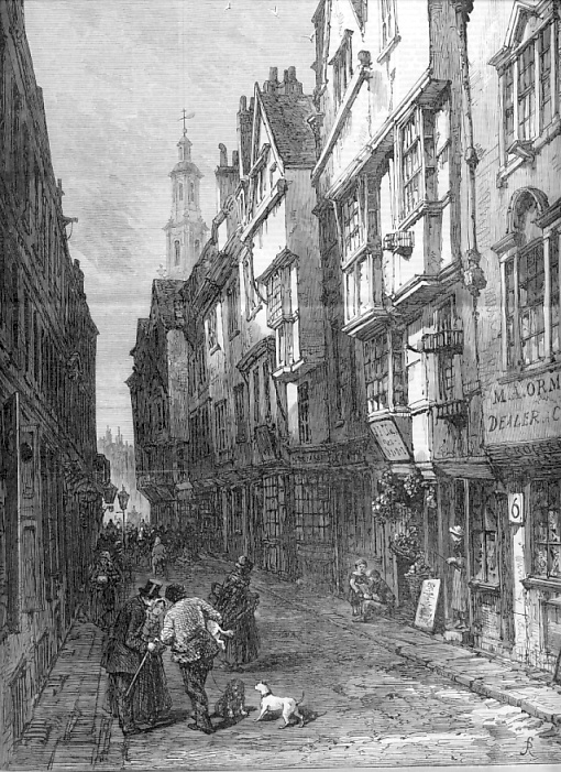
| 18:41, 22 May 2010 | Wych Street 1870.jpg ( file) |
 |
214 KB | {{Information |Description = Wych Street, London, |Source = The Illustrated London News http://gerald-massey.org.uk/bezer/b_deprivation.htm |Date = 1 January, 1870 |Author = |Permission = |other_versions = }} |
| 18:31, 22 May 2010 | Boundary Street 1890 2.JPG ( file) |
 |
42 KB | {{Information |Description = Boundary Street, Bethnal Green, part of the Old Nichol, in 1890, shortly before demolition |Source = http://www.alabaster.org.uk/chron17.htm |Date = 1890 |Author = |Permission = |
| 10:15, 22 May 2010 | Cellar dwelling nichol street 1863.jpg ( file) |
 |
56 KB | {{Information |Description = "Cellar dwelling in Nichol Street" Picture included in "More Revelations of Bethnal Green" article in "The Builder", vol. XXI, no. 1082 (31st October 1863) |Source = http://www.mernick.org.uk//thhol/p_oldni2.html |
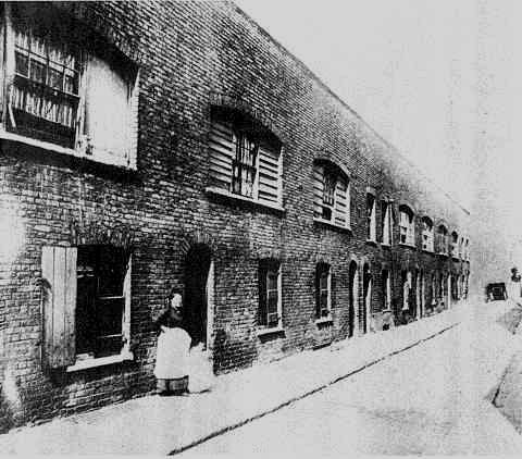
| 22:14, 17 May 2010 | Worker's homes Canning Town 1850.gif ( file) |
 |
17 KB | {{Information |Description = The first worker's homes built in Canning Town around 1850. |Source = http://www.lalamy.demon.co.uk/plaistow.htm |Date = 1850 |Author = |Permission = |other_versions = }} |
| 21:59, 17 May 2010 | Lincoln's Inn Field 1889.jpg ( file) |
 |
129 KB | {{Information |Description = Poverty map showing Lincoln's Inn Field from Charles Booth's Labour and Life of the People. Volume 1: East London (London: Macmillan, 1889). The streets are colored to represent the economic class of the re |
This special page shows all files uploaded to the English Wikipedia. (See also the list for Wikimedia Commons.) By default, the last uploaded files are shown at top of the list, but clicking on a column header will change the sorting.
Deleted files are not shown here but are included in the upload log.
| Date | Name | Thumbnail | Size | Description |
|---|---|---|---|---|
| 20:23, 11 September 2011 | Clare Market slum.jpg ( file) |
|
11 KB | {{Information |Description = Buildings in New Inn Passage, Houghton Street, London, in what was called the 'Clare Market Slum'. This cluster of narrow, dirty streets lined with butchers' and greengrocers' shops was shortly to be demolished as part of |
| 19:49, 14 August 2011 | Commercial Road booth map.jpg ( file) |
|
93 KB | {{Information |Description = Poverty map showing Commercial Road from Charles Booth's Labour and Life of the People. Volume 1: East London (London: Macmillan, 1889). The streets are colored to represent the economic class of the reside |
| 16:04, 14 August 2011 | Digital Opportunity.jpg ( file) |
|
50 KB | {{Information |Description = Cover page of Digital Opportunity – A Review of Intellectual Property and Growth by Prof Ian Hargreaves, May 2011 |Source = http://www.ipo.gov.uk/ipreview.htm |Date = May 2011 |Author |
| 01:16, 15 January 2011 | Mill's logic 1867.jpg ( file) |
|
71 KB | {{Information |Description = 'Mill's logic' (Punch cartoon) The cartoon mocks John Stuart Mill's attempt to replace the term 'man' with 'person', ie give women the right to vote, in the second Reform Bill of 1867. PRO LIBRARY Punch, p.129 (30 Marc |
| 17:08, 20 November 2010 | Deptford slum.jpg ( file) |
|
38 KB | {{Information |Description = A cobbled slum street in a Deptford, London, Circa 1900 |Source = http://www.museumoflondonprints.com/image.php?id=227234&idx=4&fromsearch=true |Date = 1900-1910 |Author = unknown |Permiss |
| 20:44, 26 September 2010 | Somers town 1837.jpg ( file) |
|
208 KB | {{Information |Description = Cary's New Plan Of London And Its Vicinity 1837 - map showing Pancras, Regent's Canal, Clarendon Square, Somers Town, Pentonville, Kings Cross and Euston Square |Source = http://archivemaps.com/mapco/cary1837/cary |
| 22:28, 21 September 2010 | Devils acre.jpg ( file) |
|
89 KB | {{Information |Description = The slum area known as Devil's Acre in Westminster, London. An illustration by Gustave Dore from 'Dore's London' |Source = http://www.life.com/image/3351725 |Date = 1872 |Author = Gustave Dore |
| 19:09, 6 September 2010 | Copyright Act 1911.jpg ( file) |
|
60 KB | {{Information |Description = Cover Page of the Copyright Act 1911, also known as the Imperial Copyright Act of 1911 |Source = http://www.opsi.gov.uk/acts/acts1911/pdf/ukpga_19110046_en.pdf |Date = 16 December 1911 |Author |
| 16:39, 15 August 2010 | Music pirates in Canada 1897.png ( file) |
|
497 KB | {{Information |Description = Article published in The New York Times about copyright infringement in Canada and the USA. "Music Pirates in Canada American Publishers Say They Are Suffering by Copyright Violations There – Steps Taken |
| 21:12, 30 June 2010 | Note to the Poor on Cholera 1848 West Ham.jpg ( file) |
|
55 KB | {{Information |Description = Notice to the poor on cholera, 1848. From the minutes of the West Ham Board of Guardians |Source = http://apps.newham.gov.uk/History_canningtown/pic20.htm |Date = 1848 |Author = West Ham Board |
| 20:52, 30 June 2010 | Bidder Street 1891.jpg ( file) |
|
40 KB | {{Information |Description = This was one of the oldest parts of Canning Town, London. |Source = http://apps.newham.gov.uk/History_canningtown/pic37.htm |Date = 1891 |Author = |Permission = |other_versions = } |
| 19:51, 26 June 2010 | Map Old Nichol area 1908.jpg ( file) |
|
83 KB | {{Information |Description = 1908 Map of the Old Nichol area, London, after slum clearance |Source = http://archivemaps.com/mapco/bart1908/bart24.htm and http://archivemaps.com/mapco/bart1908/bart25.htm |Date = 1908 |Author |
| 19:29, 26 June 2010 | Canning Town and Royal Victoria Dock 1908.jpg ( file) |
|
270 KB | {{Information |Description = 1908 Map of Canning Town and Royal Victoria Dock, London |Source = http://archivemaps.com/mapco/bart1908/bart39.htm and http://archivemaps.com/mapco/bart1908/bart40.htm |Date = 1908 |Author = B |
| 19:03, 26 June 2010 | Greenwich Peninsula 1872.jpg ( file) |
|
238 KB | {{Information |Description = Map c1872 showing Greenwich Peninsula and part of the Isle of Dogs, London |Source = http://archivemaps.com/mapco/wyld1872/wyld22.htm |Date = 1872 |Author = http://archivemaps.com/mapco/wyld187 |
| 17:33, 26 June 2010 | St James Park and Whitehall 1897.jpg ( file) |
|
187 KB | {{Information |Description = 1897 Map, St James Park and Whitehall, London |Source = http://archivemaps.com/mapco/stanford/stan53.htm |Date = 1897 |Author = Stanford's Map Of Central London 1897 |Permission = |other |
| 17:03, 26 June 2010 | Southwark and Vauxhall Water Works Reservoirs 1897.jpg ( file) |
|
136 KB | {{Information |Description = Map Southwark and Vauxhall Water Works Reservoirs, Vauxhall, 1897 |Source = http://archivemaps.com/mapco/stanford/stan52.htm |Date = 1897 |Author = Stanford's Map Of Central London 1897 |Permi |
| 16:58, 26 June 2010 | Victoria station 1897.jpg ( file) |
|
235 KB | {{Information |Description = Map 1897, Victoria Station, London |Source = http://archivemaps.com/mapco/stanford/stan52.htm |Date = 1897 |Author = Stanford's Map Of Central London 1897 |Permission = |other_versions = |
| 16:52, 26 June 2010 | Buckingham palace 1897.jpg ( file) |
|
165 KB | {{Information |Description = 1897 Map Buckingham Palace |Source = http://archivemaps.com/mapco/stanford/stan52.htm |Date = 1897 |Author = Stanford's Map Of Central London 1897 |Permission = |other_versions = }} |
| 16:44, 26 June 2010 | Chelsea Barracks map 1897.jpg ( file) |
|
172 KB | {{Information |Description = 1897 Map, Chelsea Barracks, Victoria Bridge and Royal Hospital Chelsea |Source = http://archivemaps.com/mapco/stanford/stan51.htm |Date = 1897 |Author = Stanford's Map Of Central London 1897 | |
| 16:18, 26 June 2010 | Parish of Bethnal Green 1848.gif ( file) |
|
2.16 MB | {{Information |Description = 1848 Map of the Parish of Bethnal Green |Source = http://www.victorianlondon.org/frame-maps.htm |Date = 1848 |Author = Victorian London - Publications - Social Investigation/Journalism - Sanita |
| 19:17, 22 May 2010 | Little Tommy Lee sewer.jpg ( file) |
|
28 KB | {{Information |Description = The Little Tommy Lee sewer, Canning Town, London. This picture shows the Little Tommy Lee sewer, an open sewer at the back of Pretoria Road in Canning Town. 1888 |Source = Newham Archives and Local Studies |
| 18:41, 22 May 2010 | Wych Street 1870.jpg ( file) |
|
214 KB | {{Information |Description = Wych Street, London, |Source = The Illustrated London News http://gerald-massey.org.uk/bezer/b_deprivation.htm |Date = 1 January, 1870 |Author = |Permission = |other_versions = }} |
| 18:31, 22 May 2010 | Boundary Street 1890 2.JPG ( file) |
|
42 KB | {{Information |Description = Boundary Street, Bethnal Green, part of the Old Nichol, in 1890, shortly before demolition |Source = http://www.alabaster.org.uk/chron17.htm |Date = 1890 |Author = |Permission = |
| 10:15, 22 May 2010 | Cellar dwelling nichol street 1863.jpg ( file) |
|
56 KB | {{Information |Description = "Cellar dwelling in Nichol Street" Picture included in "More Revelations of Bethnal Green" article in "The Builder", vol. XXI, no. 1082 (31st October 1863) |Source = http://www.mernick.org.uk//thhol/p_oldni2.html |
| 22:14, 17 May 2010 | Worker's homes Canning Town 1850.gif ( file) |
|
17 KB | {{Information |Description = The first worker's homes built in Canning Town around 1850. |Source = http://www.lalamy.demon.co.uk/plaistow.htm |Date = 1850 |Author = |Permission = |other_versions = }} |
| 21:59, 17 May 2010 | Lincoln's Inn Field 1889.jpg ( file) |
|
129 KB | {{Information |Description = Poverty map showing Lincoln's Inn Field from Charles Booth's Labour and Life of the People. Volume 1: East London (London: Macmillan, 1889). The streets are colored to represent the economic class of the re |