Photos • Location
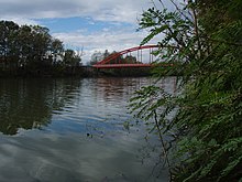
View of Spačva

| Spačva | |
|---|---|
 | |
| Location | |
| Country | Croatia |
| Physical characteristics | |
| Mouth | |
• location | Bosut |
• coordinates | 45°03′52″N 19°04′35″E / 45.0645°N 19.0765°E |
| Length | 40.2 km (25.0 mi) |
| Basin features | |
| Progression | Bosut→ Sava→ Danube→ Black Sea |

Spačva is a small river in eastern Croatia. It rises in the swampy Spačva region, takes in river Breznica, and flows into the Bosut between Lipovac and Apševci. It is also linked with Studva, and its entire course is 40.2 km (25.0 mi) long. [1]
See also
References
- ^ "Statistic description of Brod Regimente in third decade of 19th century". Scrinia Slavonica (in Croatian). 3 (1). November 2003.
Hydrography of
Croatia | ||||||
|---|---|---|---|---|---|---|
| Rivers |
|  | ||||
| Lakes | ||||||
| Valleys, estuaries, canyons, wetlands | ||||||
| Waterfalls | ||||||
| Canals |
| |||||
| Adriatic Sea | ||||||
|
| This Vukovar-Syrmia County geography article is a stub. You can help Wikipedia by expanding it. |
| Spačva | |
|---|---|
|
| |
| Location | |
| Country | Croatia |
| Physical characteristics | |
| Mouth | |
• location | Bosut |
• coordinates | 45°03′52″N 19°04′35″E / 45.0645°N 19.0765°E |
| Length | 40.2 km (25.0 mi) |
| Basin features | |
| Progression | Bosut→ Sava→ Danube→ Black Sea |
Spačva is a small river in eastern Croatia. It rises in the swampy Spačva region, takes in river Breznica, and flows into the Bosut between Lipovac and Apševci. It is also linked with Studva, and its entire course is 40.2 km (25.0 mi) long. [1]
See also
References
- ^ "Statistic description of Brod Regimente in third decade of 19th century". Scrinia Slavonica (in Croatian). 3 (1). November 2003.
Hydrography of
Croatia | ||||||
|---|---|---|---|---|---|---|
| Rivers |
| | ||||
| Lakes | ||||||
| Valleys, estuaries, canyons, wetlands | ||||||
| Waterfalls | ||||||
| Canals |
| |||||
| Adriatic Sea | ||||||
|
| This Vukovar-Syrmia County geography article is a stub. You can help Wikipedia by expanding it. |