Soanierana Ivongo | |
|---|---|
 Soanierana Ivongo from spâce | |
| Coordinates: 16°55′S 49°35′E / 16.917°S 49.583°E | |
| Country | |
| Region | Analanjirofo |
| District | Soanierana Ivongo |
| Area | |
| • Total | 203 km2 (78 sq mi) |
| Elevation | 11 m (36 ft) |
| Population (2018)
[3] | |
| • Total | 26,990 |
| • Density | 148/km2 (380/sq mi) |
| Time zone | UTC3 ( EAT) |
| Postal code | 516 |
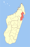
Soanierana Ivongo is a rural municipality in Madagascar. It belongs to the district of Soanierana Ivongo, which is a part of Analanjirofo Region. The population of the commune was estimated to be approximately 26,990 in 2018.
Soanierana Ivongo Ville has a riverine harbour. In addition to primary schooling the town offers secondary education at both junior and senior levels. The town provides access to hospital services to its citizens. [4] 24 fokontany (villages) are part of this municipality.
The majority 80% of the population of the commune are farmers. The most important crops are cloves and lychee, while other important agricultural products are coffee, rice and vanilla. Services provide employment for 15% of the population. Additionally fishing employs 5% of the population. [4]
Infrastructure
Soanierana Ivongo is found along the National Road No.5 from Toamasina (165 km) to Maroantsetra (227 km). [5]
It is also the town where the ferry to Nosy Boraha (ile Sainte-Marie) leaves.
Rivers
In its north the town is bordered by the Marimbona river.
Nature
References
- ^ PCDEA - Plan Communal de Développement de l’Eau et de l’Assainissement
- ^ Estimated based on DEM data from Shuttle Radar Topography Mission
- ^ TROISIEME RECENSEMENT GENERAL DE LA POPULATION ET DE L’HABITATION
- ^ a b "ILO census data". Cornell University. 2002. Retrieved 2008-03-08.
- ^ Video on You-bube
16°55′S 49°35′E / 16.917°S 49.583°E
Soanierana Ivongo | |
|---|---|
 Soanierana Ivongo from spâce | |
| Coordinates: 16°55′S 49°35′E / 16.917°S 49.583°E | |
| Country | |
| Region | Analanjirofo |
| District | Soanierana Ivongo |
| Area | |
| • Total | 203 km2 (78 sq mi) |
| Elevation | 11 m (36 ft) |
| Population (2018)
[3] | |
| • Total | 26,990 |
| • Density | 148/km2 (380/sq mi) |
| Time zone | UTC3 ( EAT) |
| Postal code | 516 |
Soanierana Ivongo is a rural municipality in Madagascar. It belongs to the district of Soanierana Ivongo, which is a part of Analanjirofo Region. The population of the commune was estimated to be approximately 26,990 in 2018.
Soanierana Ivongo Ville has a riverine harbour. In addition to primary schooling the town offers secondary education at both junior and senior levels. The town provides access to hospital services to its citizens. [4] 24 fokontany (villages) are part of this municipality.
The majority 80% of the population of the commune are farmers. The most important crops are cloves and lychee, while other important agricultural products are coffee, rice and vanilla. Services provide employment for 15% of the population. Additionally fishing employs 5% of the population. [4]
Infrastructure
Soanierana Ivongo is found along the National Road No.5 from Toamasina (165 km) to Maroantsetra (227 km). [5]
It is also the town where the ferry to Nosy Boraha (ile Sainte-Marie) leaves.
Rivers
In its north the town is bordered by the Marimbona river.
Nature
References
- ^ PCDEA - Plan Communal de Développement de l’Eau et de l’Assainissement
- ^ Estimated based on DEM data from Shuttle Radar Topography Mission
- ^ TROISIEME RECENSEMENT GENERAL DE LA POPULATION ET DE L’HABITATION
- ^ a b "ILO census data". Cornell University. 2002. Retrieved 2008-03-08.
- ^ Video on You-bube
16°55′S 49°35′E / 16.917°S 49.583°E

