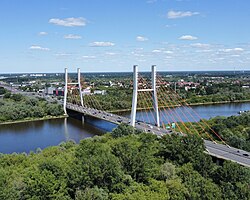
Siekierki Bridge | |
|---|---|
 | |
| Coordinates | 52°12′53″N 21°05′36″E / 52.21485°N 21.093228°E |
| Crosses | Vistula |
| Locale | Warsaw. Poland |
| Official name | Most Siekierkowski |
| Characteristics | |
| Design | Cable-stayed bridge |
| Total length | 500 m (1,600 ft) |
| Width | 33 m (108 ft) |
| Height | 87 m (285 ft) |
| History | |
| Construction end | 2002 |
| Opened | September 21, 2002 |
| Statistics | |
| Toll | Free |
| Location | |
|
| |
Siekierki Bridge ( Polish: Most Siekierkowski, Polish pronunciation: [ɕɛ̇cɛrˈkɔvski]) is a cable-stayed bridge bridge over the Vistula river in Warsaw. Poland, [1] connecting its Mokotów, Praga Południe and Wawer districts ( Siekierki, Augustówka, Gocław and Las neighborhoods), belonging to a wider expressway route, i.e. Siekierki Way. [2] The bridge is 500 m (1,600 ft) long [1] and 33.38 m (110 ft) wide, [2] with three lanes for vehicles, a pavement and a cycle path each way.[ citation needed] The structure is supported by two H- pylons, [1] each 87.07 m (286 ft) high. [2]
The bridge, named after the nearby neighborhood of Siekierki, located on its Western side, was opened for use on September 21, 2002. Until the completion of Anna Jagiellon Bridge in 2020 it had remained Warsaw's southernmost bridge.
See also
References
- ^ a b c Lagoda, M; Olaszek, P (October 2004). "Monitoring of the new bridge assembling technology". In Watanabe, E; Frangopol, D M; Utsunomiya, T (eds.). Numerical Modelling of Discrete Materials in Geotechnical Engineering, Civil Engineering and Earth Sciences. First International UDEC/3DEC Symposium. Bochum, Germany: CRC Press. p. 217. ISBN 978-90-5809-680-7.
- ^ a b c "Siekierkowski Bridge (Warsaw, 2002)". Structurae. 2001-12-15. Retrieved 2019-10-04.
Siekierki Bridge | |
|---|---|
 | |
| Coordinates | 52°12′53″N 21°05′36″E / 52.21485°N 21.093228°E |
| Crosses | Vistula |
| Locale | Warsaw. Poland |
| Official name | Most Siekierkowski |
| Characteristics | |
| Design | Cable-stayed bridge |
| Total length | 500 m (1,600 ft) |
| Width | 33 m (108 ft) |
| Height | 87 m (285 ft) |
| History | |
| Construction end | 2002 |
| Opened | September 21, 2002 |
| Statistics | |
| Toll | Free |
| Location | |
|
| |
Siekierki Bridge ( Polish: Most Siekierkowski, Polish pronunciation: [ɕɛ̇cɛrˈkɔvski]) is a cable-stayed bridge bridge over the Vistula river in Warsaw. Poland, [1] connecting its Mokotów, Praga Południe and Wawer districts ( Siekierki, Augustówka, Gocław and Las neighborhoods), belonging to a wider expressway route, i.e. Siekierki Way. [2] The bridge is 500 m (1,600 ft) long [1] and 33.38 m (110 ft) wide, [2] with three lanes for vehicles, a pavement and a cycle path each way.[ citation needed] The structure is supported by two H- pylons, [1] each 87.07 m (286 ft) high. [2]
The bridge, named after the nearby neighborhood of Siekierki, located on its Western side, was opened for use on September 21, 2002. Until the completion of Anna Jagiellon Bridge in 2020 it had remained Warsaw's southernmost bridge.
See also
References
- ^ a b c Lagoda, M; Olaszek, P (October 2004). "Monitoring of the new bridge assembling technology". In Watanabe, E; Frangopol, D M; Utsunomiya, T (eds.). Numerical Modelling of Discrete Materials in Geotechnical Engineering, Civil Engineering and Earth Sciences. First International UDEC/3DEC Symposium. Bochum, Germany: CRC Press. p. 217. ISBN 978-90-5809-680-7.
- ^ a b c "Siekierkowski Bridge (Warsaw, 2002)". Structurae. 2001-12-15. Retrieved 2019-10-04.