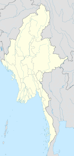
Photos • Location
Shwegyin | |
|---|---|
Town | |
| Coordinates: 17°55′0″N 96°53′0″E / 17.91667°N 96.88333°E | |
| Country | |
| Region | |
| District | Bago |
| Township | Shwegyin |
| Time zone | UTC+6.30 ( MST) |
| Area code | 54 |
| [1] | |
Shwegyin [2] is a town in Bago District, Pegu region in Burma (Myanmar). It is the administrative seat of Shwegyin Township.
Climate
| Climate data for Shwegyin (1981–2010) | |||||||||||||
|---|---|---|---|---|---|---|---|---|---|---|---|---|---|
| Month | Jan | Feb | Mar | Apr | May | Jun | Jul | Aug | Sep | Oct | Nov | Dec | Year |
| Mean daily maximum °C (°F) | 32.6 (90.7) |
34.6 (94.3) |
37.1 (98.8) |
38.2 (100.8) |
34.7 (94.5) |
30.7 (87.3) |
29.8 (85.6) |
29.7 (85.5) |
31.4 (88.5) |
33.2 (91.8) |
33.3 (91.9) |
32.1 (89.8) |
33.1 (91.6) |
| Mean daily minimum °C (°F) | 15.7 (60.3) |
17.5 (63.5) |
20.8 (69.4) |
24.4 (75.9) |
24.9 (76.8) |
24.1 (75.4) |
23.8 (74.8) |
23.8 (74.8) |
23.8 (74.8) |
23.4 (74.1) |
20.8 (69.4) |
16.8 (62.2) |
21.7 (71.1) |
| Average rainfall mm (inches) | 1.6 (0.06) |
3.7 (0.15) |
6.8 (0.27) |
46.2 (1.82) |
247.8 (9.76) |
656.2 (25.83) |
797.9 (31.41) |
837.9 (32.99) |
424.0 (16.69) |
197.6 (7.78) |
39.2 (1.54) |
1.6 (0.06) |
3,260.5 (128.37) |
| Source: Norwegian Meteorological Institute [3] | |||||||||||||
References
- ^ "National Telephone Area Codes". Myanmar's Net.
- ^ "Shwegyin". GEOnet Names Server. United States National Geospatial-Intelligence Agency.
- ^ "Myanmar Climate Report" (PDF). Norwegian Meteorological Institute. pp. 23–36. Archived from the original (PDF) on 8 October 2018. Retrieved 30 November 2018.
External links
Shwegyin | |
|---|---|
Town | |
| Coordinates: 17°55′0″N 96°53′0″E / 17.91667°N 96.88333°E | |
| Country | |
| Region | |
| District | Bago |
| Township | Shwegyin |
| Time zone | UTC+6.30 ( MST) |
| Area code | 54 |
| [1] | |
Shwegyin [2] is a town in Bago District, Pegu region in Burma (Myanmar). It is the administrative seat of Shwegyin Township.
Climate
| Climate data for Shwegyin (1981–2010) | |||||||||||||
|---|---|---|---|---|---|---|---|---|---|---|---|---|---|
| Month | Jan | Feb | Mar | Apr | May | Jun | Jul | Aug | Sep | Oct | Nov | Dec | Year |
| Mean daily maximum °C (°F) | 32.6 (90.7) |
34.6 (94.3) |
37.1 (98.8) |
38.2 (100.8) |
34.7 (94.5) |
30.7 (87.3) |
29.8 (85.6) |
29.7 (85.5) |
31.4 (88.5) |
33.2 (91.8) |
33.3 (91.9) |
32.1 (89.8) |
33.1 (91.6) |
| Mean daily minimum °C (°F) | 15.7 (60.3) |
17.5 (63.5) |
20.8 (69.4) |
24.4 (75.9) |
24.9 (76.8) |
24.1 (75.4) |
23.8 (74.8) |
23.8 (74.8) |
23.8 (74.8) |
23.4 (74.1) |
20.8 (69.4) |
16.8 (62.2) |
21.7 (71.1) |
| Average rainfall mm (inches) | 1.6 (0.06) |
3.7 (0.15) |
6.8 (0.27) |
46.2 (1.82) |
247.8 (9.76) |
656.2 (25.83) |
797.9 (31.41) |
837.9 (32.99) |
424.0 (16.69) |
197.6 (7.78) |
39.2 (1.54) |
1.6 (0.06) |
3,260.5 (128.37) |
| Source: Norwegian Meteorological Institute [3] | |||||||||||||
References
- ^ "National Telephone Area Codes". Myanmar's Net.
- ^ "Shwegyin". GEOnet Names Server. United States National Geospatial-Intelligence Agency.
- ^ "Myanmar Climate Report" (PDF). Norwegian Meteorological Institute. pp. 23–36. Archived from the original (PDF) on 8 October 2018. Retrieved 30 November 2018.


