Photos • Location
39°52′N 44°54′E / 39.867°N 44.900°E
Shaghap
Շաղափ | |
|---|---|
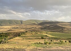
 Mountains near Shaghap | |
| Coordinates: 39°52′N 44°54′E / 39.867°N 44.900°E | |
| Country | Armenia |
| Province | Ararat |
| Municipality | Vedi |
| Elevation | 1,300 m (4,300 ft) |
| Population (2001) | |
| • Total | 899 |
| Time zone | UTC+4 |
Shaghap ( Armenian: Շաղափ) is a village in the Vedi Municipality of the Ararat Province of Armenia.
References
39°52′N 44°54′E / 39.867°N 44.900°E
Shaghap
Շաղափ | |
|---|---|
 Mountains near Shaghap | |
| Coordinates: 39°52′N 44°54′E / 39.867°N 44.900°E | |
| Country | Armenia |
| Province | Ararat |
| Municipality | Vedi |
| Elevation | 1,300 m (4,300 ft) |
| Population (2001) | |
| • Total | 899 |
| Time zone | UTC+4 |
Shaghap ( Armenian: Շաղափ) is a village in the Vedi Municipality of the Ararat Province of Armenia.


