Photos • Location
| Schwarzenstein | |
|---|---|
 | |
| Highest point | |
| Elevation | 3,368 m (11,050 ft) |
| Listing | Alpine mountains above 3000 m |
| Coordinates | 47°1′N 11°52′E / 47.017°N 11.867°E |
| Geography | |
| Location | Tyrol, Austria / South Tyrol, Italy |
| Parent range | Zillertal Alps |
| Climbing | |
| First ascent | 1852 by Lieutenant Langer; 1858 by Anton von Ruthner, J. Daum, L.v. Barth and Georg Samer |
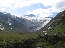
The Schwarzenstein ( Italian: Sasso Nero; German: Schwarzenstein) is a mountain in the Zillertal Alps on the border between Tyrol, Austria, and South Tyrol, Italy.
References
- Heinrich Klier, Walter Klier: Alpine Club Guide Zillertaler Alpen, Munich, 1996, ISBN 3-7633-1269-2
- Alpine Club Map 1:25,000, Sheet 35/2, Zillertaler Alpen, Mitte
External links
![]() Media related to
Schwarzenstein (Zillertaler Alpen) at Wikimedia Commons
Media related to
Schwarzenstein (Zillertaler Alpen) at Wikimedia Commons
| Schwarzenstein | |
|---|---|
 | |
| Highest point | |
| Elevation | 3,368 m (11,050 ft) |
| Listing | Alpine mountains above 3000 m |
| Coordinates | 47°1′N 11°52′E / 47.017°N 11.867°E |
| Geography | |
| Location | Tyrol, Austria / South Tyrol, Italy |
| Parent range | Zillertal Alps |
| Climbing | |
| First ascent | 1852 by Lieutenant Langer; 1858 by Anton von Ruthner, J. Daum, L.v. Barth and Georg Samer |
The Schwarzenstein ( Italian: Sasso Nero; German: Schwarzenstein) is a mountain in the Zillertal Alps on the border between Tyrol, Austria, and South Tyrol, Italy.
References
- Heinrich Klier, Walter Klier: Alpine Club Guide Zillertaler Alpen, Munich, 1996, ISBN 3-7633-1269-2
- Alpine Club Map 1:25,000, Sheet 35/2, Zillertaler Alpen, Mitte
External links
![]() Media related to
Schwarzenstein (Zillertaler Alpen) at Wikimedia Commons
Media related to
Schwarzenstein (Zillertaler Alpen) at Wikimedia Commons