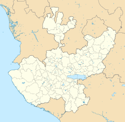
Photos • Location
Santa Rita | |
|---|---|
Town | |
| Coordinates: 20°26′31″N 102°23′38″W / 20.44207°N 102.3938°W | |
| Country | Mexico |
| State | Jalisco |
| Municipality | Ayotlán |
| Elevation | 1,579 m (5,180 ft) |
| Population (2020) | |
| • Total | 2,608 |
| Time zone | UTC−6 ( Central Standard Time) |
| • Summer ( DST) | UTC−5 ( Central Daylight Time) |
| Postal code | 47904
[2] |
Santa Rita is a town in the southwest of the Ayotlán Municipality, Jalisco. It has 2,608 inhabitants during the 2020 Mexico census, [1] it is located at 11.4 km from Ayotlán, 36 km from Atotonilco El Alto and 21 km from Yurécuaro, Michoacán. [3]
This place is better known due to the water park [4] located at the entrance of the town, towards Yurécuaro.
References
- ^ a b "Santa Rita (Ayotlán, Jalisco)". pueblosamerica.com. Retrieved 27 July 2022.
- ^ "Santa Rita, Ayotlán - 47904". micodigopostal.org.
- ^ "Santa Rita Jalisco (Ayotlán) Mexico". www.en.nuestro-mexico.com. Retrieved 27 July 2022.
- ^ "Parqué Acuático Santa Rita". www.parqueacuaticosantarita.com.mx (in Spanish). Retrieved 27 July 2022.

