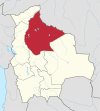
Photos • Location
You can help expand this article with text translated from
the corresponding article in German. (August 2011) Click [show] for important translation instructions.
|
San Ramón Municipality (Mamoré) | |
|---|---|
Municipality | |
| Country | |
| Department | Beni Department |
| Province | Mamoré Province |
| Seat | San Ramón |
| Time zone | UTC-4 (BOT) |
San Ramón Municipality is a municipality of the Beni Department, Bolivia.
References
- (in Spanish) Instituto Nacional de Estadistica de Bolivia (INE)
