Photos • Location
This article needs additional citations for
verification. (December 2009) |
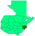
San Jacinto (Spanish pronunciation: [saŋ xaˈsinto]) is a municipality, in the Chiquimula department of Guatemala. It has a population of 12,619 (2018 census) [1] and cover an area of 72 km2.
References
- ^ Citypopulation.de Population of departments and municipalities in Guatemala
