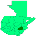
Photos • Location
San Carlos Alzatate | |
|---|---|
Municipality | |
| Country |
|
| Department |
|
| Area | |
| • Municipality | 80.2 km2 (31.0 sq mi) |
| Population (2018 census)
[1] | |
| • Municipality | 18,977 |
| • Density | 240/km2 (610/sq mi) |
| • Urban | 8,906 |
San Carlos Alzatate is a municipality in the Jalapa department of Guatemala.
References
- ^ Citypopulation.de Population of departments and municipalities
14°30′N 90°04′W / 14.500°N 90.067°W
