Photos • Location
Salt Creek Covered Bridge | |
 | |
| Nearest city | Norwich, Ohio |
|---|---|
| Coordinates | 39°59′57″N 81°50′23″W / 39.99917°N 81.83972°W |
| Area | less than one acre |
| Built | 1876 |
| Built by | Fisher, Thomas; Romine, Jesse |
| Architectural style | Warren truss |
| NRHP reference No. | 74001587 [1] |
| Added to NRHP | September 10, 1974 |
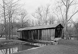
The Salt Creek Covered Bridge, near Norwich in Perry Township, Muskingum County, Ohio, was built in 1876. It was listed on the National Register of Historic Places in 1974. [1]
It is located 3 miles (4.8 km) northwest of Norwich.
It spans Salt Creek about 10 miles (16 km) east of Zanesville, Ohio and is a Warren truss bridge. [2]
See also
References
- ^ a b "National Register Information System". National Register of Historic Places. National Park Service. November 2, 2013.
- ^ Lorrie K. Owen, ed. (1999). Ohio Historic Places Dictionary. Vol. 2. Somerset Publishers, Inc. p. 1111. Retrieved September 8, 2018.
External links
-
 Media related to
Salt Creek Bridge, Norwich, Ohio at Wikimedia Commons
 - Historic American Engineering Record (HAER) No. OH-126, " Harshman Bridge, Spanning Four Mile Creek, Concord-Fairhaven Road, Fairhaven, Preble County, OH", 10 photos, 6 data pages, 1 photo caption page
Salt Creek Covered Bridge | |
 | |
| Nearest city | Norwich, Ohio |
|---|---|
| Coordinates | 39°59′57″N 81°50′23″W / 39.99917°N 81.83972°W |
| Area | less than one acre |
| Built | 1876 |
| Built by | Fisher, Thomas; Romine, Jesse |
| Architectural style | Warren truss |
| NRHP reference No. | 74001587 [1] |
| Added to NRHP | September 10, 1974 |
The Salt Creek Covered Bridge, near Norwich in Perry Township, Muskingum County, Ohio, was built in 1876. It was listed on the National Register of Historic Places in 1974. [1]
It is located 3 miles (4.8 km) northwest of Norwich.
It spans Salt Creek about 10 miles (16 km) east of Zanesville, Ohio and is a Warren truss bridge. [2]
See also
References
- ^ a b "National Register Information System". National Register of Historic Places. National Park Service. November 2, 2013.
- ^ Lorrie K. Owen, ed. (1999). Ohio Historic Places Dictionary. Vol. 2. Somerset Publishers, Inc. p. 1111. Retrieved September 8, 2018.
External links
-
 Media related to
Salt Creek Bridge, Norwich, Ohio at Wikimedia Commons
 - Historic American Engineering Record (HAER) No. OH-126, " Harshman Bridge, Spanning Four Mile Creek, Concord-Fairhaven Road, Fairhaven, Preble County, OH", 10 photos, 6 data pages, 1 photo caption page
