Photos • Location

This article has multiple issues. Please help
improve it or discuss these issues on the
talk page. (
Learn how and when to remove these template messages)
|
Sainte-Cécile
Sinte-Cicile (Gaumais) | |
|---|---|
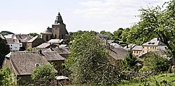
 General view | |
| Coordinates: 49°43.7′N 05°14.5′E / 49.7283°N 5.2417°E | |
| Country | |
| Region | |
| Province | |
| Municipality | |
| Postal code | 6820 |
| Area code | 061 |
Sainte-Cécile (French pronunciation:
[sɛ̃t sesil];
Gaumais: Sinte-Cicile) is a
village of
Wallonia and a district of the
municipality of
Florenville, located in the
province of Luxembourg,
Belgium.
The village is bordered in the east by the Semois, a tributary to the Meuse river.
- Official web site (in French)
Wikimedia Commons has media related to
Sainte-Cécile.
This article has multiple issues. Please help
improve it or discuss these issues on the
talk page. (
Learn how and when to remove these template messages)
|
Sainte-Cécile
Sinte-Cicile (Gaumais) | |
|---|---|
 General view | |
| Coordinates: 49°43.7′N 05°14.5′E / 49.7283°N 5.2417°E | |
| Country | |
| Region | |
| Province | |
| Municipality | |
| Postal code | 6820 |
| Area code | 061 |
Sainte-Cécile (French pronunciation:
[sɛ̃t sesil];
Gaumais: Sinte-Cicile) is a
village of
Wallonia and a district of the
municipality of
Florenville, located in the
province of Luxembourg,
Belgium.
The village is bordered in the east by the Semois, a tributary to the Meuse river.
- Official web site (in French)
Wikimedia Commons has media related to
Sainte-Cécile.

