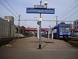
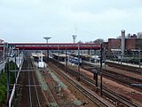
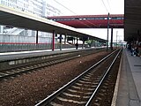
Saint-Quentin-en-Yvelines‚ÄďMontigny-le-Bretonneux is a station on the Paris‚ÄďBrest railway. It is served by Paris's express suburban rail system, the RER Line C and by suburban Transilien Line N and U services. The station opened in 1975. [1] It is within Montigny-le-Bretonneux.
-
-
-
-
 Bus interchange


- ^ Société de géographie (1976). Acta geographica (in French). Société de géographie. p. 38.
- Saint-Quentin-en-Yvelines‚ÄďMontigny-le-Bretonneux station at Transilien, the official website of SNCF (in French)
| Preceding station |
|
Following station | ||
|---|---|---|---|---|
| Terminus | RER C |
Saint-Cyr towards
Saint-Martin-d'√Čtampes
| ||
| Preceding station |
|
Following station | ||
|
Trappes towards
Rambouillet
|
Line N |
Saint-Cyr towards
Paris‚ÄďMontparnasse
| ||
|
Trappes towards
La Verrière
|
Line U |
Saint-Cyr towards
La Défense
| ||
48¬į47‚Ä≤14‚Ä≥N 2¬į02‚Ä≤40‚Ä≥E / 48.78722¬įN 2.04444¬įE
|
| This Réseau Express Régional article is a stub. You can help Wikipedia by expanding it. |
Saint-Quentin-en-Yvelines‚ÄďMontigny-le-Bretonneux is a station on the Paris‚ÄďBrest railway. It is served by Paris's express suburban rail system, the RER Line C and by suburban Transilien Line N and U services. The station opened in 1975. [1] It is within Montigny-le-Bretonneux.
-
-
-
-
Bus interchange
- ^ Société de géographie (1976). Acta geographica (in French). Société de géographie. p. 38.
- Saint-Quentin-en-Yvelines‚ÄďMontigny-le-Bretonneux station at Transilien, the official website of SNCF (in French)
| Preceding station |
|
Following station | ||
|---|---|---|---|---|
| Terminus | RER C |
Saint-Cyr towards
Saint-Martin-d'√Čtampes
| ||
| Preceding station |
|
Following station | ||
|
Trappes towards
Rambouillet
|
Line N |
Saint-Cyr towards
Paris‚ÄďMontparnasse
| ||
|
Trappes towards
La Verrière
|
Line U |
Saint-Cyr towards
La Défense
| ||
48¬į47‚Ä≤14‚Ä≥N 2¬į02‚Ä≤40‚Ä≥E / 48.78722¬įN 2.04444¬įE
|
| This Réseau Express Régional article is a stub. You can help Wikipedia by expanding it. |