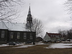
Saint-Jean-Chrysostome | |
|---|---|
Borough | |
 | |
| Country | Canada |
| Province | Quebec |
| MRC | Lévis |
| Established | 1828 |
| Government | |
| • Type | Borough |
| Area | |
| • Total | 85.80 km2 (33.13 sq mi) |
| Population (2006)
[1] | |
| • Total | 18,061 |
| Time zone | UTC-5 ( EST) |
| • Summer ( DST) | UTC-4 ( EDT) |
Saint-Jean-Chrysostome is a sector within the Les Chutes-de-la-Chaudière-Est borough of the city of Lévis in central Quebec, Canada south of Quebec City on the south bank of the Saint Lawrence River. It was a separate town, incorporated in 1828, but in 2002 was amalgamated into Lévis. [1]
It is a mostly suburban community, connected to Quebec City by bus ( Société de transport de Lévis) via Sainte-Foy. The main high school is École secondaire l'Horizon.
According to the Canada 2006 Census:
- Population: 18,016
- % Change (2001–2006): +5.4
- Dwellings: 6,513
- Area (km2): 85.80 km2
- Density (persons per km2): 210.0
References
- ^ "Banque de noms de lieux du Québec: Reference number 373174". toponymie.gouv.qc.ca (in French). Commission de toponymie du Québec.
46°43′4″N 71°11′52″W / 46.71778°N 71.19778°W
Saint-Jean-Chrysostome | |
|---|---|
Borough | |
 | |
| Country | Canada |
| Province | Quebec |
| MRC | Lévis |
| Established | 1828 |
| Government | |
| • Type | Borough |
| Area | |
| • Total | 85.80 km2 (33.13 sq mi) |
| Population (2006)
[1] | |
| • Total | 18,061 |
| Time zone | UTC-5 ( EST) |
| • Summer ( DST) | UTC-4 ( EDT) |
Saint-Jean-Chrysostome is a sector within the Les Chutes-de-la-Chaudière-Est borough of the city of Lévis in central Quebec, Canada south of Quebec City on the south bank of the Saint Lawrence River. It was a separate town, incorporated in 1828, but in 2002 was amalgamated into Lévis. [1]
It is a mostly suburban community, connected to Quebec City by bus ( Société de transport de Lévis) via Sainte-Foy. The main high school is École secondaire l'Horizon.
According to the Canada 2006 Census:
- Population: 18,016
- % Change (2001–2006): +5.4
- Dwellings: 6,513
- Area (km2): 85.80 km2
- Density (persons per km2): 210.0
References
- ^ "Banque de noms de lieux du Québec: Reference number 373174". toponymie.gouv.qc.ca (in French). Commission de toponymie du Québec.
46°43′4″N 71°11′52″W / 46.71778°N 71.19778°W