Photos • Location
Sabra | |
|---|---|
Commune and town | |
 | |
 | |
| Coordinates: 34°49′38.57″N 1°31′41.74″W / 34.8273806°N 1.5282611°W | |
| Country | |
| Province | Tlemcen Province |
| Population (2008) | |
| • Total | 28,555 |
| Time zone | UTC+1 ( CET) |
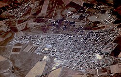
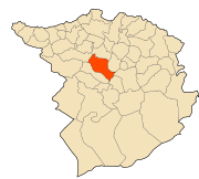
Sabra (formerly Turenne during the French colonization) is a commune of Tlemcen in Algeria., [1] it has a famous water source called ain sabra [2]
- ^ "Communes of Algeria". Statoids. Retrieved December 12, 2010.
- ^ "Ain Sabra ( la source de Sabra, Algerie)". dz.geoview.info. Retrieved 2016-07-18.
34°50′N 1°32′W / 34.833°N 1.533°W
Sabra | |
|---|---|
Commune and town | |
 | |
 | |
| Coordinates: 34°49′38.57″N 1°31′41.74″W / 34.8273806°N 1.5282611°W | |
| Country | |
| Province | Tlemcen Province |
| Population (2008) | |
| • Total | 28,555 |
| Time zone | UTC+1 ( CET) |
Sabra (formerly Turenne during the French colonization) is a commune of Tlemcen in Algeria., [1] it has a famous water source called ain sabra [2]
- ^ "Communes of Algeria". Statoids. Retrieved December 12, 2010.
- ^ "Ain Sabra ( la source de Sabra, Algerie)". dz.geoview.info. Retrieved 2016-07-18.
34°50′N 1°32′W / 34.833°N 1.533°W

