Rudd also known as Piney is an unincorporated community in southern Carroll County, Arkansas, United States. [1] The community is located among mountain peaks along Piney Creek on Arkansas Highway 103. Gobbler lies to the southeast and Metalton lies to the northwest. [2] The site is at an elevation of 1,447 ft (441 m). [1]
A post office named Piney was opened at the site in 1873, but was closed and replaced by the Rudd post office in 1892 and remained in operation until 1957. [3]
References
- ^ a b U.S. Geological Survey Geographic Names Information System: Rudd, Arkansas
- ^ Arkansas Atlas & Gazetteer, DeLorme, 2nd ed., 2004, p. 23 ISBN 0-89933-345-1
- ^ History of Rudd
Municipalities and communities of
Carroll County, Arkansas, United States | ||
|---|---|---|
| Cities | 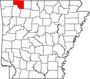 | |
| Towns | ||
| Townships | ||
|
Unincorporated communities | ||
| Ghost towns | ||
| Footnotes | ‡This populated place also has portions in an adjacent county or counties | |
36°12′49″N 93°29′10″W / 36.21361°N 93.48611°W
|
| This article about a location in Carroll County, Arkansas is a stub. You can help Wikipedia by expanding it. |
Rudd also known as Piney is an unincorporated community in southern Carroll County, Arkansas, United States. [1] The community is located among mountain peaks along Piney Creek on Arkansas Highway 103. Gobbler lies to the southeast and Metalton lies to the northwest. [2] The site is at an elevation of 1,447 ft (441 m). [1]
A post office named Piney was opened at the site in 1873, but was closed and replaced by the Rudd post office in 1892 and remained in operation until 1957. [3]
References
- ^ a b U.S. Geological Survey Geographic Names Information System: Rudd, Arkansas
- ^ Arkansas Atlas & Gazetteer, DeLorme, 2nd ed., 2004, p. 23 ISBN 0-89933-345-1
- ^ History of Rudd
Municipalities and communities of
Carroll County, Arkansas, United States | ||
|---|---|---|
| Cities | | |
| Towns | ||
| Townships | ||
|
Unincorporated communities | ||
| Ghost towns | ||
| Footnotes | ‡This populated place also has portions in an adjacent county or counties | |
36°12′49″N 93°29′10″W / 36.21361°N 93.48611°W
|
| This article about a location in Carroll County, Arkansas is a stub. You can help Wikipedia by expanding it. |