This article needs additional citations for
verification. (December 2009) |
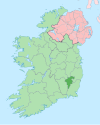
Royal Oak ( Irish: An Dair Ríoga) [1] is a small village in County Carlow, Ireland. It is on the west side of the River Barrow, across from Bagenalstown, and is off the former N9 road (now R448 road from Naas to Waterford). It is not in or a part of Bagenalstown.
Royal Oak is within the townland of Clorusk (from Irish Cloch Rusc, meaning 'stone house of the moor/marsh'). [2]
- ^ "An Dair Ríoga/Royal Oak". logainm.ie. Retrieved 7 March 2023.
- ^ Placenames Database of Ireland
52°42′03″N 6°59′08″W / 52.70083°N 6.98556°W
