Photos • Location
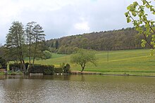
Rosenthal, the monastery pond

| Rodenbach | |
|---|---|
| Location | |
| Country | Germany |
| State | Rhineland-Palatinate |
| Location | Palatine Forest |
| Reference no. | DE: 239186 |
| Physical characteristics | |
| Source | |
| • location | West of the Rosenthalerhof |
| • coordinates | 49°33′34″N 8°00′09″E / 49.559364°N 8.002477°E |
| • elevation | 320 m above sea level (NHN) |
| Mouth | |
• location | In Ebertsheim from the left into the Eisbach |
• coordinates | 49°34′04″N 8°06′53″E / 49.567854°N 8.114593°E |
• elevation | ca. 160 m above sea level (NHN) |
| Length | 9.847 km (6.119 mi) [1] |
| Basin size | 19.299 km2 (7.451 sq mi) [1] |
| Basin features | |
| Progression | Eisbach→ Rhine→ North Sea |
| Landmarks | Villages: Kerzenheim, Ebertsheim |
| Tributaries | |
| • left | Kerzenheimer Bach, Stehrbach, Mangelbach |
| Waterbodies | Reservoirs: Rosenthaler Weiher |
,_der_Klosterteich.JPG)
The Rodenbach is a stream, just under 10 kilometres (6.2 mi) long, and an orographically left-hand headstream of the Eisbach in the northeastern part of the Palatine Forest in the German state of Rhineland-Palatinate.
See also
References
| Rodenbach | |
|---|---|
| Location | |
| Country | Germany |
| State | Rhineland-Palatinate |
| Location | Palatine Forest |
| Reference no. | DE: 239186 |
| Physical characteristics | |
| Source | |
| • location | West of the Rosenthalerhof |
| • coordinates | 49°33′34″N 8°00′09″E / 49.559364°N 8.002477°E |
| • elevation | 320 m above sea level (NHN) |
| Mouth | |
• location | In Ebertsheim from the left into the Eisbach |
• coordinates | 49°34′04″N 8°06′53″E / 49.567854°N 8.114593°E |
• elevation | ca. 160 m above sea level (NHN) |
| Length | 9.847 km (6.119 mi) [1] |
| Basin size | 19.299 km2 (7.451 sq mi) [1] |
| Basin features | |
| Progression | Eisbach→ Rhine→ North Sea |
| Landmarks | Villages: Kerzenheim, Ebertsheim |
| Tributaries | |
| • left | Kerzenheimer Bach, Stehrbach, Mangelbach |
| Waterbodies | Reservoirs: Rosenthaler Weiher |
The Rodenbach is a stream, just under 10 kilometres (6.2 mi) long, and an orographically left-hand headstream of the Eisbach in the northeastern part of the Palatine Forest in the German state of Rhineland-Palatinate.
See also
References