Rožnik | |
|---|---|
 | |
| Coordinates: 45°53′56.2″N 14°38′39.95″E / 45.898944°N 14.6444306°E | |
| Country |
|
| Traditional region | Lower Carniola |
| Statistical region | Central Slovenia |
| Municipality | Grosuplje |
| Area | |
| • Total | 1.67 km2 (0.64 sq mi) |
| Elevation | 461.7 m (1,514.8 ft) |
| Population (2002) | |
| • Total | 47 |
| [1] | |
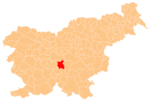
Rožnik (pronounced [ˈɾoːʒnik], locally also Roženpah, [2] German: Rosenbach [3]) is a small settlement in the Municipality of Grosuplje in central Slovenia. It lies east of Velike Lipljene just off the regional road leading south from Šent Jurij to Turjak. The area is part of the historical region of Lower Carniola. The municipality is now included in the Central Slovenia Statistical Region. [4]
-
Rožnik in 1948
- ^ Statistical Office of the Republic of Slovenia Archived November 18, 2008, at the Wayback Machine
- ^ Savnik, Roman (1971). Krajevni leksikon Slovenije, vol. 2. Ljubljana: Državna založba Slovenije. p. 148.
- ^ Leksikon občin kraljestev in dežel zastopanih v državnem zboru, vol. 6: Kranjsko. Vienna: C. Kr. Dvorna in Državna Tiskarna. 1906. p. 110.
- ^ Grosuplje municipal site
-
 Media related to
Rožnik at Wikimedia Commons
 - Rožnik on Geopedia
Rožnik | |
|---|---|
 | |
| Coordinates: 45°53′56.2″N 14°38′39.95″E / 45.898944°N 14.6444306°E | |
| Country |
|
| Traditional region | Lower Carniola |
| Statistical region | Central Slovenia |
| Municipality | Grosuplje |
| Area | |
| • Total | 1.67 km2 (0.64 sq mi) |
| Elevation | 461.7 m (1,514.8 ft) |
| Population (2002) | |
| • Total | 47 |
| [1] | |
Rožnik (pronounced [ˈɾoːʒnik], locally also Roženpah, [2] German: Rosenbach [3]) is a small settlement in the Municipality of Grosuplje in central Slovenia. It lies east of Velike Lipljene just off the regional road leading south from Šent Jurij to Turjak. The area is part of the historical region of Lower Carniola. The municipality is now included in the Central Slovenia Statistical Region. [4]
-
Rožnik in 1948
- ^ Statistical Office of the Republic of Slovenia Archived November 18, 2008, at the Wayback Machine
- ^ Savnik, Roman (1971). Krajevni leksikon Slovenije, vol. 2. Ljubljana: Državna založba Slovenije. p. 148.
- ^ Leksikon občin kraljestev in dežel zastopanih v državnem zboru, vol. 6: Kranjsko. Vienna: C. Kr. Dvorna in Državna Tiskarna. 1906. p. 110.
- ^ Grosuplje municipal site
-
 Media related to
Rožnik at Wikimedia Commons
 - Rožnik on Geopedia


