Riderwood, Alabama | |
|---|---|
 Riderwood  Riderwood | |
| Coordinates: 32°07′44″N 88°19′40″W / 32.12889°N 88.32778°W | |
| Country | United States |
| State | Alabama |
| County | Choctaw |
| Elevation | 213 ft (65 m) |
| Time zone | UTC-6 ( Central (CST)) |
| • Summer ( DST) | UTC-5 (CDT) |
| Area code(s) | 205 and 659 |
| GNIS feature ID | 125626 [1] |
Riderwood is an unincorporated community in Choctaw County, Alabama, United States.
History
Riderwood is named after J. B. Rider, who was the president of the E. E. Jackson Lumber Company. [2] Riderwood was founded by the E. E. Jackson Lumber Company and was located on the Alabama, Tennessee and Northern Railroad. Riderwood was formerly an incorporated town. [3] It was also home to a company store, theater, and hotel. [4]
The Alabama Department of Public Health carried out malaria control operations in Riderwood beginning in 1918. [5]
A post office operated under the name Riderwood from 1916 to 1974. [6]
The Riderwood Union Church was built by the E. E. Jackson Lumber Company for its workers and is listed on the Alabama Register of Landmarks and Heritage. [7]
References
- ^ "Riderwood". Geographic Names Information System. United States Geological Survey, United States Department of the Interior.
- ^ Foscue, Virginia (1989). Place Names in Alabama. Tuscaloosa: The University of Alabama Press. p. 118. ISBN 0-8173-0410-X.
- ^ Alabama. Dept. of Archives and History (1920). Alabama Official and Statistical Register. Brown Printing Company. p. 248.
- ^ Sandra Jenkins Little (2017). Choctaw County. Arcadia Publishing. p. 8. ISBN 978-1-4671-2693-9.
- ^ Alabama State Board of Health (1922). Annual Report of the State Board of Health of Alabama. pp. 92–3.
- ^ "Choctaw County". Jim Forte Postal History. Retrieved March 1, 2020.
- ^ "Riderwood Union Church" (PDF). Alabama Historical Commission. Retrieved March 1, 2020.
Municipalities and communities of
Choctaw County, Alabama, United States | ||
|---|---|---|
| Towns | 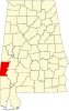 | |
| CDP | ||
|
Unincorporated communities | ||
| Footnotes | ‡This populated place also has portions in an adjacent county or counties | |
|
| This Choctaw County, Alabama state location article is a stub. You can help Wikipedia by expanding it. |
Riderwood, Alabama | |
|---|---|
Riderwood Riderwood | |
| Coordinates: 32°07′44″N 88°19′40″W / 32.12889°N 88.32778°W | |
| Country | United States |
| State | Alabama |
| County | Choctaw |
| Elevation | 213 ft (65 m) |
| Time zone | UTC-6 ( Central (CST)) |
| • Summer ( DST) | UTC-5 (CDT) |
| Area code(s) | 205 and 659 |
| GNIS feature ID | 125626 [1] |
Riderwood is an unincorporated community in Choctaw County, Alabama, United States.
History
Riderwood is named after J. B. Rider, who was the president of the E. E. Jackson Lumber Company. [2] Riderwood was founded by the E. E. Jackson Lumber Company and was located on the Alabama, Tennessee and Northern Railroad. Riderwood was formerly an incorporated town. [3] It was also home to a company store, theater, and hotel. [4]
The Alabama Department of Public Health carried out malaria control operations in Riderwood beginning in 1918. [5]
A post office operated under the name Riderwood from 1916 to 1974. [6]
The Riderwood Union Church was built by the E. E. Jackson Lumber Company for its workers and is listed on the Alabama Register of Landmarks and Heritage. [7]
References
- ^ "Riderwood". Geographic Names Information System. United States Geological Survey, United States Department of the Interior.
- ^ Foscue, Virginia (1989). Place Names in Alabama. Tuscaloosa: The University of Alabama Press. p. 118. ISBN 0-8173-0410-X.
- ^ Alabama. Dept. of Archives and History (1920). Alabama Official and Statistical Register. Brown Printing Company. p. 248.
- ^ Sandra Jenkins Little (2017). Choctaw County. Arcadia Publishing. p. 8. ISBN 978-1-4671-2693-9.
- ^ Alabama State Board of Health (1922). Annual Report of the State Board of Health of Alabama. pp. 92–3.
- ^ "Choctaw County". Jim Forte Postal History. Retrieved March 1, 2020.
- ^ "Riderwood Union Church" (PDF). Alabama Historical Commission. Retrieved March 1, 2020.
Municipalities and communities of
Choctaw County, Alabama, United States | ||
|---|---|---|
| Towns | | |
| CDP | ||
|
Unincorporated communities | ||
| Footnotes | ‡This populated place also has portions in an adjacent county or counties | |
|
| This Choctaw County, Alabama state location article is a stub. You can help Wikipedia by expanding it. |