Photos • Location
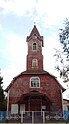
Iglesia Nuestra Señora de Lourdes, Reumén.

Reumén | |
|---|---|
| Coordinates: 39°59′24″S 72°49′58″W / 39.99000°S 72.83278°W | |
| Region | Los Ríos |
| Province | Valdivia |
| Municipality | Paillaco |
| Commune | Paillaco |
| Government | |
| • Type | Municipal |
| Elevation | 68 m (223 ft) |
| Population (2002 census
[1]) | |
| • Total | 947 |
| Time zone | UTC−04:00 (Chilean Standard) |
| • Summer ( DST) | UTC−03:00 (Chilean Daylight) |
| Area code | Country + town = 56 + 63 |

Reumén is a village ( Spanish: pueblo) located along Chile's Southern Railway about 8 km north of Paillaco. The village is bordered in the southeast by Collilelfu River.
Railway stations in Southern Chile | ||
|---|---|---|
| Main line | ||
| Ramal Valdivia–Antilhue | ||
| Ramal Los Lagos–Riñihue | ||
|
| This Los Ríos Region location article is a stub. You can help Wikipedia by expanding it. |
Reumén | |
|---|---|
| Coordinates: 39°59′24″S 72°49′58″W / 39.99000°S 72.83278°W | |
| Region | Los Ríos |
| Province | Valdivia |
| Municipality | Paillaco |
| Commune | Paillaco |
| Government | |
| • Type | Municipal |
| Elevation | 68 m (223 ft) |
| Population (2002 census
[1]) | |
| • Total | 947 |
| Time zone | UTC−04:00 (Chilean Standard) |
| • Summer ( DST) | UTC−03:00 (Chilean Daylight) |
| Area code | Country + town = 56 + 63 |
Reumén is a village ( Spanish: pueblo) located along Chile's Southern Railway about 8 km north of Paillaco. The village is bordered in the southeast by Collilelfu River.
Railway stations in Southern Chile | ||
|---|---|---|
| Main line | ||
| Ramal Valdivia–Antilhue | ||
| Ramal Los Lagos–Riñihue | ||
|
| This Los Ríos Region location article is a stub. You can help Wikipedia by expanding it. |