| Reni Commercial Seaport | |
|---|---|
 | |
|
Click on the map for a fullscreen view | |
Native name | Ренійський морський порт |
| Location | |
| Country | |
| Location | Reni, Izmail Raion, Odesa Oblast [1] |
| Coordinates | 45°25′15″N 28°17′25″E / 45.42083°N 28.29028°E |
| Details | |
| Opened | December, 1816 |
| Head of the Port | Yuriy Kononenko |
| Statistics | |
| Annual cargo tonnage | 1.3 million tons (December 20, 2021) [2] [3] |
| Website www.portreni.com.ua | |
The Reni Seaport is a port located on the left bank of the Danube. It is an important transport hub [4] of Ukraine, where the work of river, sea, road, and rail transport is closely intertwined. Navigation takes place throughout the year. The maximum depth near the berths is 3.5–12 m (average 7.5 m), which allows you to handle any type of cargo. According to the Law of Ukraine "On Seaports of Ukraine," the functions of the seaport administration are performed by the Rhine branch of the state enterprise of the Ukrainian Sea Ports Authority. [5] The Reni port has been damaged as a result of the 2022 Russian invasion of Ukraine.
Gallery
-
 Port facilities
 -
 Port entrance
 -
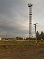 Tower
Tower -
 Main entrance
 -
 Customs gate


See also
References
- ^ "Ренійський морський торговельний порт". unian.ua. Retrieved April 12, 2022.
- ^ "Ренійський порт виконав річний план з вантажопереробки". agravery.com. 21 December 2021. Retrieved April 12, 2022.
- ^ "Порт Рені виконав річний план з переробки вантажів". agrotimes.ua. 20 December 2021. Retrieved April 12, 2022.
- ^ "Морський порт Рені" (in Ukrainian). Retrieved 2023-07-09.
- ^ "Хороші показники: Ренійський морський порт виконав річний план з вантажопереробки". sudohodstvo.org. 21 December 2021. Retrieved April 12, 2022.
| Black Sea | ||
|---|---|---|
| Azov Sea | ||
| River | ||
| Ferry | ||
|
South China Sea (owned) | ||
(*) Crimea ports are occupied by Russia | ||
|
| This article related to ports, harbors or marinas is a stub. You can help Wikipedia by expanding it. |
| Reni Commercial Seaport | |
|---|---|
|
| |
|
Click on the map for a fullscreen view | |
Native name | Ренійський морський порт |
| Location | |
| Country | |
| Location | Reni, Izmail Raion, Odesa Oblast [1] |
| Coordinates | 45°25′15″N 28°17′25″E / 45.42083°N 28.29028°E |
| Details | |
| Opened | December, 1816 |
| Head of the Port | Yuriy Kononenko |
| Statistics | |
| Annual cargo tonnage | 1.3 million tons (December 20, 2021) [2] [3] |
| Website www.portreni.com.ua | |
The Reni Seaport is a port located on the left bank of the Danube. It is an important transport hub [4] of Ukraine, where the work of river, sea, road, and rail transport is closely intertwined. Navigation takes place throughout the year. The maximum depth near the berths is 3.5–12 m (average 7.5 m), which allows you to handle any type of cargo. According to the Law of Ukraine "On Seaports of Ukraine," the functions of the seaport administration are performed by the Rhine branch of the state enterprise of the Ukrainian Sea Ports Authority. [5] The Reni port has been damaged as a result of the 2022 Russian invasion of Ukraine.
Gallery
-
Port facilities
-
Port entrance
-
Tower
-
Main entrance
-
Customs gate
See also
References
- ^ "Ренійський морський торговельний порт". unian.ua. Retrieved April 12, 2022.
- ^ "Ренійський порт виконав річний план з вантажопереробки". agravery.com. 21 December 2021. Retrieved April 12, 2022.
- ^ "Порт Рені виконав річний план з переробки вантажів". agrotimes.ua. 20 December 2021. Retrieved April 12, 2022.
- ^ "Морський порт Рені" (in Ukrainian). Retrieved 2023-07-09.
- ^ "Хороші показники: Ренійський морський порт виконав річний план з вантажопереробки". sudohodstvo.org. 21 December 2021. Retrieved April 12, 2022.
| Black Sea | ||
|---|---|---|
| Azov Sea | ||
| River | ||
| Ferry | ||
|
South China Sea (owned) | ||
(*) Crimea ports are occupied by Russia | ||
|
| This article related to ports, harbors or marinas is a stub. You can help Wikipedia by expanding it. |