Photos • Location

 | |
|
| |
| Location | Saint Philip, Barbados |
|---|---|
| Coordinates | 13°09′49″N 59°25′58″W / 13.163726°N 59.432906°W |
| Tower | |
| Constructed | 1875 |
| Construction | limestone |
| Height | 29.5 metres (97 ft) |
| Shape | cylindrical tower with balcony and lantern |
| Markings | white tower and black lantern |
| Light | |
| Deactivated | 2007-2011 |
| Focal height | 65 metres (213 ft) |
| Range | 3 nmi (5.6 km; 3.5 mi)
|
| Characteristic | F R |
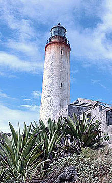
Ragged Point Lighthouse is situated at the easternmost point of the island of Barbados, [1] near the village of Ragged Point in the parish of Saint Philip.
See also
References
- ^ Rowlett, Russ. "Lighthouses of Barbados". The Lighthouse Directory. University of North Carolina at Chapel Hill. Retrieved December 18, 2015.
External links
Wikimedia Commons has media related to
Ragged Point Lighthouse.
- (in French) De sommet en sommet, les Alpes en péril (broadcast to French/German TV Arte) : Ragged point as the best spot for climatologists to monitor cloud formations in the Caribbean Sea, like Hawaii for the Pacific High ; hence the German Max Planck Institute for Meteorology settled a Climate research center there.