RAF Hornby Hall No. 9 SLG | |||||||||||
|---|---|---|---|---|---|---|---|---|---|---|---|
| Summary | |||||||||||
| Airport type | Military | ||||||||||
| Owner | Air Ministry | ||||||||||
| Operator | Royal Air Force | ||||||||||
| Location | Penrith, Cumbria | ||||||||||
| Built | 1941 | ||||||||||
| In use | 1941-1945 | ||||||||||
| Elevation AMSL | 443 ft / 135 m | ||||||||||
| Coordinates | 54°39′26″N 002°39′51″W / 54.65722°N 2.66417°W | ||||||||||
| Map | |||||||||||
| Runways | |||||||||||
| |||||||||||
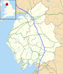
RAF Hornby Hall was a Royal Air Force satellite landing ground located near Brougham, 4 miles (6.4 km) east of Penrith, Cumbria and 8.8 miles (14.2 km) north west of Appleby-in-Westmorland, Cumbria, England.
The airfield was opened on 17 March 1941, and was mostly used by No. 22 Maintenance Unit RAF (MU) at RAF Silloth but changed to No. 12 MU at RAF Kirkbride. [1] [2]
The landing ground was also temporarily operated by No. 18 MU at RAF Dumfries sometime between July and September 1940. [3] Closure came in July 1945, when the site was converted into a PoW camp for German prisoners. [4]
- ^ Smith 1990, p. 102.
- ^ "Hornby Hall - Satellite Landing Ground". Russell W. Barnes. Retrieved 8 September 2012.
- ^ "History of RAF Dumfries". Dumfries and Galloway Aviation Museum. Retrieved 8 September 2012.
- ^ Smith 1990, p. 103.
- Smith, David J. (1990) [1981]. Action Stations 3: Military Airfields of Wales and the North-West. Wellingborough: Patrick Stephens. ISBN 1-85260-375-5.
