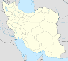
Photos • Location
Qazvin Airport | |||||||||||
|---|---|---|---|---|---|---|---|---|---|---|---|
 | |||||||||||
| Summary | |||||||||||
| Airport type | Public | ||||||||||
| Owner | Qazvin Municipality | ||||||||||
| Operator | Qazvin Municipality | ||||||||||
| Serves | Qazvin Province | ||||||||||
| Location | Qazvin, Iran | ||||||||||
| Elevation AMSL | 4,184 ft / 1,275 m | ||||||||||
| Coordinates | 36°14′24.2″N 050°02′49.8″E / 36.240056°N 50.047167°E | ||||||||||
| Map | |||||||||||
| Runways | |||||||||||
| |||||||||||
Source:World Aero Data
[1] | |||||||||||
Qazvin Airport ( IATA: GZW, ICAO: OIIK) is an airport in Qazvin, which is the capital city of Iran's Qazvin province. [2]
References
-
^
"WORLD AERO DATA - GHAZVIN". Archived from the original on March 4, 2016. Retrieved 9 November 2015.
{{
cite web}}
: CS1 maint: unfit URL ( link) - ^ "List of all airports in Iran". The Airport Authority. Retrieved 2019-01-02.
External links
Qazvin Airport | |||||||||||
|---|---|---|---|---|---|---|---|---|---|---|---|
 | |||||||||||
| Summary | |||||||||||
| Airport type | Public | ||||||||||
| Owner | Qazvin Municipality | ||||||||||
| Operator | Qazvin Municipality | ||||||||||
| Serves | Qazvin Province | ||||||||||
| Location | Qazvin, Iran | ||||||||||
| Elevation AMSL | 4,184 ft / 1,275 m | ||||||||||
| Coordinates | 36°14′24.2″N 050°02′49.8″E / 36.240056°N 50.047167°E | ||||||||||
| Map | |||||||||||
| Runways | |||||||||||
| |||||||||||
Source:World Aero Data
[1] | |||||||||||
Qazvin Airport ( IATA: GZW, ICAO: OIIK) is an airport in Qazvin, which is the capital city of Iran's Qazvin province. [2]
References
-
^
"WORLD AERO DATA - GHAZVIN". Archived from the original on March 4, 2016. Retrieved 9 November 2015.
{{
cite web}}
: CS1 maint: unfit URL ( link) - ^ "List of all airports in Iran". The Airport Authority. Retrieved 2019-01-02.
External links
