Pulaski, Georgia | |
|---|---|
 Town hall and post office | |
 Location in
Candler County and the state of
Georgia | |
| Coordinates: 32°23′28″N 81°57′22″W / 32.39111°N 81.95611°W | |
| Country | United States |
| State | Georgia |
| County | Candler |
| Area | |
| • Total | 0.80 sq mi (2.07 km2) |
| • Land | 0.80 sq mi (2.06 km2) |
| • Water | 0.00 sq mi (0.01 km2) |
| Elevation | 210 ft (64 m) |
| Population (
2020) | |
| • Total | 211 |
| • Density | 264.74/sq mi (102.26/km2) |
| Time zone | UTC-5 ( Eastern (EST)) |
| • Summer ( DST) | UTC-4 (EDT) |
| ZIP code | 30451 |
| Area code | 912 |
| FIPS code | 13-63000 [2] |
| GNIS feature ID | 0321217 [3] |
| Website |
georgiainfo |
Pulaski is a town in Candler County, Georgia, United States. The population was 211 in 2020.
The Georgia General Assembly incorporated Pulaski as a town in 1905. [4] The town was named for Count Casimir Pulaski, a Revolutionary War hero. [5]
Pulaski is located in eastern Candler County at 32°23′28″N 81°57′22″W / 32.39111°N 81.95611°W (32.390979, -81.956167). [6] Georgia State Route 46 passes through the town, leading west 6 miles (10 km) to Metter, the county seat. Interstate 16, an east–west highway connecting Savannah and Macon, is 3.5 miles (5.6 km) to the south.
According to the United States Census Bureau, Pulaski has a total area of 0.81 square miles (2.1 km2), all of it land. [7]
| Census | Pop. | Note | %± |
|---|---|---|---|
| 1910 | 207 | — | |
| 1940 | 241 | — | |
| 1950 | 234 | −2.9% | |
| 1960 | 155 | −33.8% | |
| 1970 | 230 | 48.4% | |
| 1980 | 257 | 11.7% | |
| 1990 | 264 | 2.7% | |
| 2000 | 261 | −1.1% | |
| 2010 | 266 | 1.9% | |
| 2020 | 211 | −20.7% | |
| U.S. Decennial Census [8] | |||
As of the census [2] of 2000, there were 261 people, 73 households, and 48 families residing in the town. In 2020, its population declined to 211.
- ^ "2020 U.S. Gazetteer Files". United States Census Bureau. Retrieved December 18, 2021.
- ^ a b "U.S. Census website". United States Census Bureau. Retrieved January 31, 2008.
- ^ "US Board on Geographic Names". United States Geological Survey. October 25, 2007. Retrieved January 31, 2008.
- ^ Acts and Resolutions of the General Assembly of the State of Georgia. Clark & Hines, State Printers. 1905. p. 1053.
- ^ "Profile for Pulaski, Georgia". ePodunk. Retrieved June 18, 2010.
- ^ "US Gazetteer files: 2010, 2000, and 1990". United States Census Bureau. February 12, 2011. Retrieved April 23, 2011.
- ^ "Geographic Identifiers: 2010 Demographic Profile Data (G001): Pulaski town, Georgia". U.S. Census Bureau, American Factfinder. Archived from the original on February 12, 2020. Retrieved July 18, 2014.
- ^ "Census of Population and Housing". Census.gov. Retrieved June 4, 2015.
- Pulaski historical marker
Municipalities and communities of
Candler County, Georgia, United States | ||
|---|---|---|
| City | 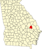 | |
| Town | ||
| Unincorporated community | ||
Pulaski, Georgia | |
|---|---|
|
Town hall and post office | |
|
Location in
Candler County and the state of
Georgia | |
| Coordinates: 32°23′28″N 81°57′22″W / 32.39111°N 81.95611°W | |
| Country | United States |
| State | Georgia |
| County | Candler |
| Area | |
| • Total | 0.80 sq mi (2.07 km2) |
| • Land | 0.80 sq mi (2.06 km2) |
| • Water | 0.00 sq mi (0.01 km2) |
| Elevation | 210 ft (64 m) |
| Population (
2020) | |
| • Total | 211 |
| • Density | 264.74/sq mi (102.26/km2) |
| Time zone | UTC-5 ( Eastern (EST)) |
| • Summer ( DST) | UTC-4 (EDT) |
| ZIP code | 30451 |
| Area code | 912 |
| FIPS code | 13-63000 [2] |
| GNIS feature ID | 0321217 [3] |
| Website |
georgiainfo |
Pulaski is a town in Candler County, Georgia, United States. The population was 211 in 2020.
The Georgia General Assembly incorporated Pulaski as a town in 1905. [4] The town was named for Count Casimir Pulaski, a Revolutionary War hero. [5]
Pulaski is located in eastern Candler County at 32°23′28″N 81°57′22″W / 32.39111°N 81.95611°W (32.390979, -81.956167). [6] Georgia State Route 46 passes through the town, leading west 6 miles (10 km) to Metter, the county seat. Interstate 16, an east–west highway connecting Savannah and Macon, is 3.5 miles (5.6 km) to the south.
According to the United States Census Bureau, Pulaski has a total area of 0.81 square miles (2.1 km2), all of it land. [7]
| Census | Pop. | Note | %± |
|---|---|---|---|
| 1910 | 207 | — | |
| 1940 | 241 | — | |
| 1950 | 234 | −2.9% | |
| 1960 | 155 | −33.8% | |
| 1970 | 230 | 48.4% | |
| 1980 | 257 | 11.7% | |
| 1990 | 264 | 2.7% | |
| 2000 | 261 | −1.1% | |
| 2010 | 266 | 1.9% | |
| 2020 | 211 | −20.7% | |
| U.S. Decennial Census [8] | |||
As of the census [2] of 2000, there were 261 people, 73 households, and 48 families residing in the town. In 2020, its population declined to 211.
- ^ "2020 U.S. Gazetteer Files". United States Census Bureau. Retrieved December 18, 2021.
- ^ a b "U.S. Census website". United States Census Bureau. Retrieved January 31, 2008.
- ^ "US Board on Geographic Names". United States Geological Survey. October 25, 2007. Retrieved January 31, 2008.
- ^ Acts and Resolutions of the General Assembly of the State of Georgia. Clark & Hines, State Printers. 1905. p. 1053.
- ^ "Profile for Pulaski, Georgia". ePodunk. Retrieved June 18, 2010.
- ^ "US Gazetteer files: 2010, 2000, and 1990". United States Census Bureau. February 12, 2011. Retrieved April 23, 2011.
- ^ "Geographic Identifiers: 2010 Demographic Profile Data (G001): Pulaski town, Georgia". U.S. Census Bureau, American Factfinder. Archived from the original on February 12, 2020. Retrieved July 18, 2014.
- ^ "Census of Population and Housing". Census.gov. Retrieved June 4, 2015.
- Pulaski historical marker
Municipalities and communities of
Candler County, Georgia, United States | ||
|---|---|---|
| City | | |
| Town | ||
| Unincorporated community | ||