Photos • Location
You can help expand this article with text translated from
the corresponding article in German. (April 2009) Click [show] for important translation instructions.
|
| Puitkogel | |
|---|---|
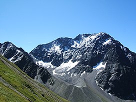
 Puitkogel from the northwest from Gabinten near the Rüsselsheimer Hütte. | |
| Highest point | |
| Elevation | 3,345 m (10,974 ft) |
| Prominence | 390 m (1,280 ft) |
| Parent peak | Hohe Geige |
| Listing | Alpine mountains above 3000 m |
| Coordinates | 46°58′53″N 10°54′05″E / 46.98139°N 10.90139°E |
| Geography | |
| Parent range | Ötztal Alps |
| Climbing | |
| First ascent | 29 Aug 1894 by F. Lantscher und F. Gstrein |
| Easiest route | South ridge from the Rüsselsheimer Hütte ( UIAA-II) |
The Puitkogel is a mountain in the Geigenkamm group of the Ötztal Alps.
You can help expand this article with text translated from
the corresponding article in German. (April 2009) Click [show] for important translation instructions.
|
| Puitkogel | |
|---|---|
 Puitkogel from the northwest from Gabinten near the Rüsselsheimer Hütte. | |
| Highest point | |
| Elevation | 3,345 m (10,974 ft) |
| Prominence | 390 m (1,280 ft) |
| Parent peak | Hohe Geige |
| Listing | Alpine mountains above 3000 m |
| Coordinates | 46°58′53″N 10°54′05″E / 46.98139°N 10.90139°E |
| Geography | |
| Parent range | Ötztal Alps |
| Climbing | |
| First ascent | 29 Aug 1894 by F. Lantscher und F. Gstrein |
| Easiest route | South ridge from the Rüsselsheimer Hütte ( UIAA-II) |
The Puitkogel is a mountain in the Geigenkamm group of the Ötztal Alps.
