Highway 821 | ||||
|---|---|---|---|---|
| Ruta 821 | ||||
| Route information | ||||
| Maintained by Puerto Rico DTPW | ||||
| Length | 6.0 km [1] (3.7 mi) | |||
| Existed | 1953 [2]–present | |||
| Major junctions | ||||
| South end | ||||
| North end | ||||
| Location | ||||
| Country | United States | |||
| Territory | Puerto Rico | |||
| Municipalities | Corozal | |||
| Highway system | ||||
| ||||

Puerto Rico Highway 821 (PR-821) is a north–south road located in the municipality of Corozal in Puerto Rico. [3] With a length of 6.0 km (3.7 mi), it begins at its intersection with PR-891 between downtown Corozal and Barrio Pueblo, passing through Abras barrio until its terminus at PR-630 near Mavilla barrio of Vega Alta municipality. [4]
Route description
This highway consists of one lane in each direction for most of its length, except in the southern terminus, where Calle San Ramón is a one-way street with a single lane from Calle Colón to PR-891. [5] After that, PR-821 heads to the north, meeting with PR-159 on its way to Abras. [6] Between Barrio Pueblo and Abras, PR-821 becomes rural, connecting several neighborhoods and sectors until its transition to PR-630 near the Vega Alta municipal limit. [4]
-
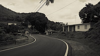 PR-821 north in Abras barrio
 -
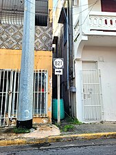 Sign for PR-821 in Corozal barrio-pueblo
 -
 PR-159 east at PR-821 junction
.jpg)
.jpg)

History
Prior to its numerical designation, PR-821 was only known as Camino del Abra. The current numerical designation corresponds to the 1953 Puerto Rico highway renumbering, a process implemented by the Puerto Rico Department of Transportation and Public Works ( Spanish: Departamento de Transportación y Obras Públicas) that increased the insular highway network to connect existing routes with different locations around Puerto Rico. [2]
Major intersections
The entire route is located in Corozal.
| Location | km [1] | mi | Destinations | Notes | |
|---|---|---|---|---|---|
| Corozal barrio-pueblo | 0.0 | 0.0 | Southern terminus of PR-821; one-way street; eastbound access via Calle Bou and Calle San Manuel | ||
| Corozal barrio-pueblo– Pueblo line | 0.4 | 0.25 | |||
| Abras | 6.0 | 3.7 | Northern terminus of PR-821 | ||
| 1.000 mi = 1.609 km; 1.000 km = 0.621 mi | |||||
See also
References
- ^ a b Google (29 February 2020). "PR-821" (Map). Google Maps. Google. Retrieved 29 February 2020.
- ^ a b "Corozal, Memoria Núm. 61" (PDF). Puerto Rico Planning Board (in Spanish). 1955. Retrieved 22 February 2020.
- ^ National Geographic Maps (2011). Puerto Rico (Map). 1:125,000. Adventure Map (Book 3107). Evergreen, Colorado: National Geographic Maps. ISBN 978-1566955188. OCLC 756511572.
- ^ a b "PR-821, Corozal, Puerto Rico". pr.geoview.info. Retrieved 7 February 2020.
- ^ "Calle San Ramón, Corozal, Puerto Rico". pr.geoview.info. Retrieved 8 August 2023.
- ^ "Tránsito Promedio Diario (AADT)". Transit Data (Datos de Transito) (in Spanish). DTOP PR. p. 130. Archived from the original on 1 April 2019.
External links
-
 Media related to
Puerto Rico Highway 821 at Wikimedia Commons
Media related to
Puerto Rico Highway 821 at Wikimedia Commons
|
| This Puerto Rico road-related article is a stub. You can help Wikipedia by expanding it. |
Highway 821 | ||||
|---|---|---|---|---|
| Ruta 821 | ||||
| Route information | ||||
| Maintained by Puerto Rico DTPW | ||||
| Length | 6.0 km [1] (3.7 mi) | |||
| Existed | 1953 [2]–present | |||
| Major junctions | ||||
| South end | ||||
| North end | ||||
| Location | ||||
| Country | United States | |||
| Territory | Puerto Rico | |||
| Municipalities | Corozal | |||
| Highway system | ||||
| ||||
Puerto Rico Highway 821 (PR-821) is a north–south road located in the municipality of Corozal in Puerto Rico. [3] With a length of 6.0 km (3.7 mi), it begins at its intersection with PR-891 between downtown Corozal and Barrio Pueblo, passing through Abras barrio until its terminus at PR-630 near Mavilla barrio of Vega Alta municipality. [4]
Route description
This highway consists of one lane in each direction for most of its length, except in the southern terminus, where Calle San Ramón is a one-way street with a single lane from Calle Colón to PR-891. [5] After that, PR-821 heads to the north, meeting with PR-159 on its way to Abras. [6] Between Barrio Pueblo and Abras, PR-821 becomes rural, connecting several neighborhoods and sectors until its transition to PR-630 near the Vega Alta municipal limit. [4]
-
PR-821 north in Abras barrio
-
Sign for PR-821 in Corozal barrio-pueblo
-
PR-159 east at PR-821 junction
History
Prior to its numerical designation, PR-821 was only known as Camino del Abra. The current numerical designation corresponds to the 1953 Puerto Rico highway renumbering, a process implemented by the Puerto Rico Department of Transportation and Public Works ( Spanish: Departamento de Transportación y Obras Públicas) that increased the insular highway network to connect existing routes with different locations around Puerto Rico. [2]
Major intersections
The entire route is located in Corozal.
| Location | km [1] | mi | Destinations | Notes | |
|---|---|---|---|---|---|
| Corozal barrio-pueblo | 0.0 | 0.0 | Southern terminus of PR-821; one-way street; eastbound access via Calle Bou and Calle San Manuel | ||
| Corozal barrio-pueblo– Pueblo line | 0.4 | 0.25 | |||
| Abras | 6.0 | 3.7 | Northern terminus of PR-821 | ||
| 1.000 mi = 1.609 km; 1.000 km = 0.621 mi | |||||
See also
References
- ^ a b Google (29 February 2020). "PR-821" (Map). Google Maps. Google. Retrieved 29 February 2020.
- ^ a b "Corozal, Memoria Núm. 61" (PDF). Puerto Rico Planning Board (in Spanish). 1955. Retrieved 22 February 2020.
- ^ National Geographic Maps (2011). Puerto Rico (Map). 1:125,000. Adventure Map (Book 3107). Evergreen, Colorado: National Geographic Maps. ISBN 978-1566955188. OCLC 756511572.
- ^ a b "PR-821, Corozal, Puerto Rico". pr.geoview.info. Retrieved 7 February 2020.
- ^ "Calle San Ramón, Corozal, Puerto Rico". pr.geoview.info. Retrieved 8 August 2023.
- ^ "Tránsito Promedio Diario (AADT)". Transit Data (Datos de Transito) (in Spanish). DTOP PR. p. 130. Archived from the original on 1 April 2019.
External links
-
Media related to
Puerto Rico Highway 821 at Wikimedia Commons
|
| This Puerto Rico road-related article is a stub. You can help Wikipedia by expanding it. |