Prospect Hill, North Carolina | |
|---|---|
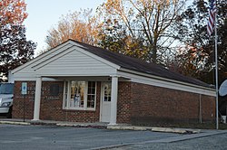
 Post office | |
| Coordinates: 36°14′57″N 79°11′27″W / 36.24917°N 79.19083°W | |
| Country | United States |
| State | North Carolina |
| County | Caswell |
| Time zone | UTC-5 ( Eastern (EST)) |
| • Summer ( DST) | UTC-4 (EDT) |
| Area code | 336 |
Prospect Hill is a small unincorporated community in Hightowers Township, Caswell County, North Carolina, United States. It lies at the intersection of North Carolina Highways 49 and 86. It is in extreme southeastern Caswell County.
Warren House and Warren's Store are listed on the National Register of Historic Places in 1973. [1]
Sugartree Creek, a tributary to South Hyco Creek, rises in this community. [2]
- ^ "National Register Information System". National Register of Historic Places. National Park Service. July 9, 2010.
- ^ "Get Maps". USGS Topoview. US Geological Survey. Retrieved 9 November 2020.
- Prospect Hill at the U.S. Geographic Names Information System
Prospect Hill, North Carolina | |
|---|---|
 Post office | |
| Coordinates: 36°14′57″N 79°11′27″W / 36.24917°N 79.19083°W | |
| Country | United States |
| State | North Carolina |
| County | Caswell |
| Time zone | UTC-5 ( Eastern (EST)) |
| • Summer ( DST) | UTC-4 (EDT) |
| Area code | 336 |
Prospect Hill is a small unincorporated community in Hightowers Township, Caswell County, North Carolina, United States. It lies at the intersection of North Carolina Highways 49 and 86. It is in extreme southeastern Caswell County.
Warren House and Warren's Store are listed on the National Register of Historic Places in 1973. [1]
Sugartree Creek, a tributary to South Hyco Creek, rises in this community. [2]
- ^ "National Register Information System". National Register of Historic Places. National Park Service. July 9, 2010.
- ^ "Get Maps". USGS Topoview. US Geological Survey. Retrieved 9 November 2020.
- Prospect Hill at the U.S. Geographic Names Information System

