Photos • Location

Potter, Arkansas | |
|---|---|
 Potter, Arkansas  Potter, Arkansas | |
| Coordinates: 34°33′13″N 94°20′21″W / 34.55361°N 94.33917°W | |
| Country | United States |
| State | Arkansas |
| County | Polk |
| Elevation | 932 ft (284 m) |
| Time zone | UTC-6 ( Central (CST)) |
| • Summer ( DST) | UTC-5 (CDT) |
| Area code | 479 |
| GNIS feature ID | 78086 [1] |
Potter (also Old Potter, Rust) is an unincorporated community in Polk County, Arkansas, United States. [1] [2]
- ^ a b "Potter, Arkansas". Geographic Names Information System. United States Geological Survey, United States Department of the Interior.
- ^ "Arkansas Department of Transportation-Polk County" (PDF). Archived from the original (PDF) on March 13, 2012. Retrieved March 15, 2018.
Municipalities and communities of
Polk County, Arkansas, United States | ||
|---|---|---|
| Cities | 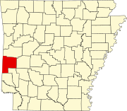 | |
| Towns | ||
| CDPs | ||
|
Other unincorporated communities | ||
|
| This article about a location in Polk County, Arkansas is a stub. You can help Wikipedia by expanding it. |
Potter, Arkansas | |
|---|---|
Potter, Arkansas Potter, Arkansas | |
| Coordinates: 34°33′13″N 94°20′21″W / 34.55361°N 94.33917°W | |
| Country | United States |
| State | Arkansas |
| County | Polk |
| Elevation | 932 ft (284 m) |
| Time zone | UTC-6 ( Central (CST)) |
| • Summer ( DST) | UTC-5 (CDT) |
| Area code | 479 |
| GNIS feature ID | 78086 [1] |
Potter (also Old Potter, Rust) is an unincorporated community in Polk County, Arkansas, United States. [1] [2]
- ^ a b "Potter, Arkansas". Geographic Names Information System. United States Geological Survey, United States Department of the Interior.
- ^ "Arkansas Department of Transportation-Polk County" (PDF). Archived from the original (PDF) on March 13, 2012. Retrieved March 15, 2018.
Municipalities and communities of
Polk County, Arkansas, United States | ||
|---|---|---|
| Cities | | |
| Towns | ||
| CDPs | ||
|
Other unincorporated communities | ||
|
| This article about a location in Polk County, Arkansas is a stub. You can help Wikipedia by expanding it. |