Posępsko | |
|---|---|
Village | |
.jpg) Road in the settlement | |
 Posępsko | |
| Coordinates: 51°01′08″N 15°45′19″E / 51.01889°N 15.75528°E | |
| Country | |
| Voivodeship | Lower Silesian |
| County | Złotoryja |
| Gmina | Świerzawa |
Posępsko [pɔˈsɛmpskɔ] is a village in the administrative district of Gmina Świerzawa, within Złotoryja County, Lower Silesian Voivodeship, in south-western Poland. [1]
It lies approximately 11 kilometres (7 mi) west of Świerzawa, 17 kilometres (11 mi) south-west of Złotoryja, and 91 kilometres (57 mi) west of the regional capital Wrocław.
-
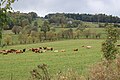 Surrounding countryside
 -
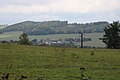 Posępsko from the distance
.jpg)
.jpg)
| Town and seat |  | |
|---|---|---|
| Villages | ||
|
| This Złotoryja County location article is a stub. You can help Wikipedia by expanding it. |
Posępsko | |
|---|---|
Village | |
|
Road in the settlement | |
Posępsko | |
| Coordinates: 51°01′08″N 15°45′19″E / 51.01889°N 15.75528°E | |
| Country | |
| Voivodeship | Lower Silesian |
| County | Złotoryja |
| Gmina | Świerzawa |
Posępsko [pɔˈsɛmpskɔ] is a village in the administrative district of Gmina Świerzawa, within Złotoryja County, Lower Silesian Voivodeship, in south-western Poland. [1]
It lies approximately 11 kilometres (7 mi) west of Świerzawa, 17 kilometres (11 mi) south-west of Złotoryja, and 91 kilometres (57 mi) west of the regional capital Wrocław.
-
Surrounding countryside
-
Posępsko from the distance
| Town and seat | | |
|---|---|---|
| Villages | ||
|
| This Złotoryja County location article is a stub. You can help Wikipedia by expanding it. |