Pojhi Kapoor | |
|---|---|
Village | |
 Pojhi Kapoor Location in Bihar, India  Pojhi Kapoor Pojhi Kapoor (India) | |
| Coordinates: 25°52′N 84°51′E / 25.87°N 84.85°E | |
| Country | |
| State | Bihar |
| District | Saran |
| Elevation | 36 m (118 ft) |
| Population (2011) | |
| • Total | 4,254 |
| Languages | |
| • Official | Hindi |
| Time zone | UTC+5:30 ( IST) |
| ISO 3166 code | IN-BR |
Pojhi Kapoor (also Pojhikpur, Pojhikapur) is a village and part of Bhualpur Panchayat of Saran district, Bihar, India. [1]
Geography
Pojhi Kapoor is located at 25°52′N 84°51′E / 25.87°N 84.85°E. [2] It has an average elevation of 36 metres.
Location
Pojhi Kapoor(Postal Code:841415) is about 15 km from district headquarters Chhapra. It falls under Bhualpur Panchayat of Marhaura Block of Saran district. Garkha is the nearest city. The village is well-connected by roads in all seasons. The nearest railway station is Chhapra(Station Code-CPR) and the nearest airport is Lok Nayak Jayaprakash Airport, Patna.
Development Works
- Water supply pipelines:
Village is equipped with pipelines for water supply. Public water taps has been also installed at few places. Village has been water rich but due to increasing population and lack of awareness for water conservation, water level goes down and due to which summers becoming hard for people nowadays. Most of hand pumps and wells dries during summer. However, supply of water is available periodically morning-evening but it is also subject to availability of electricity. One of the major issue which has been faced by farmers in past years was irrigation of crops because most of the existing old Pumps were not working at all due to Lack of Water level but this has been resolved a bit, because there are a few New Submersible Pumps installed in 2019 (private, with the help of Govt. subsidies), which allows farmers to irrigate their crops at lower rates than earlier.
Demographics
As of 2011 [update] India census, [3] Pojhi Kapoor had a population of 4254. Males constitute 55% of the population and females 45%.
Pojhi Kapoor and Pojhi Buzurg
This Village has been historically divided in two parts. The western part of Pojhi is known as Pojhi Kapoor and the eastern part of the village is known as Pojhi Buzurg.
Healthcare
- There is a Government Primary Health Care Center, which is situated at Pojhi Kapoor providing round-the-clock medical service to the local population. [4]
- Electricity supply is available 24 Hours.
Schools
Pojhi Kapoor has three primary schools and one Higher Secondary School specially for girls affiliated to Bihar School Examination Board.
- Sitaram Project Balika Uchhayatar(+2) Vidyalaya, Pojhi Kapoor
- Prathmik Vidyalya, Pojhi Kapoor
- Prathmik Kanya Vidyalya, Pojhi Buzurg
- Prathmik Vidyalya, Pojhi Buzurg
Geographical Location
Places adjacent to Pojhi Kapoor | ||||||||||||||||
|---|---|---|---|---|---|---|---|---|---|---|---|---|---|---|---|---|
| ||||||||||||||||
Gallery
-
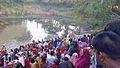 Chhath Ghat

- Lal Babu Rai, Ex-MLA Marhaura, Leader Janata Dal (United) [5]
References
- ^ "Pojhi Kapoor Village Bhualpur Panchayat Marhourah Block, saran Bihar India". Brandbihar.com. Archived from the original on 25 September 2013. Retrieved 4 October 2013.
- ^ "Get Address of Properties Near 25.8706227,84.8541869". Getaddress.net. Retrieved 4 October 2013.
- ^ "Census of India: Population Finder". Censusindia.gov.in. Archived from the original on 5 October 2013. Retrieved 4 October 2013.
- ^ "Get Address of Properties Near 25.869550243598322,84.86068367958069". Getaddress.net. Retrieved 4 October 2013.
- ^ "Lal Babu Rai Lal(Independent(IND)):Constituency- Saran(BIHAR) - Affidavit Information of Candidate:". Myneta.info. Retrieved 4 October 2013.
|
| This article related to a location in Bihar is a stub. You can help Wikipedia by expanding it. |
Pojhi Kapoor | |
|---|---|
Village | |
Pojhi Kapoor Location in Bihar, India Pojhi Kapoor Pojhi Kapoor (India) | |
| Coordinates: 25°52′N 84°51′E / 25.87°N 84.85°E | |
| Country | |
| State | Bihar |
| District | Saran |
| Elevation | 36 m (118 ft) |
| Population (2011) | |
| • Total | 4,254 |
| Languages | |
| • Official | Hindi |
| Time zone | UTC+5:30 ( IST) |
| ISO 3166 code | IN-BR |
Pojhi Kapoor (also Pojhikpur, Pojhikapur) is a village and part of Bhualpur Panchayat of Saran district, Bihar, India. [1]
Geography
Pojhi Kapoor is located at 25°52′N 84°51′E / 25.87°N 84.85°E. [2] It has an average elevation of 36 metres.
Location
Pojhi Kapoor(Postal Code:841415) is about 15 km from district headquarters Chhapra. It falls under Bhualpur Panchayat of Marhaura Block of Saran district. Garkha is the nearest city. The village is well-connected by roads in all seasons. The nearest railway station is Chhapra(Station Code-CPR) and the nearest airport is Lok Nayak Jayaprakash Airport, Patna.
Development Works
- Water supply pipelines:
Village is equipped with pipelines for water supply. Public water taps has been also installed at few places. Village has been water rich but due to increasing population and lack of awareness for water conservation, water level goes down and due to which summers becoming hard for people nowadays. Most of hand pumps and wells dries during summer. However, supply of water is available periodically morning-evening but it is also subject to availability of electricity. One of the major issue which has been faced by farmers in past years was irrigation of crops because most of the existing old Pumps were not working at all due to Lack of Water level but this has been resolved a bit, because there are a few New Submersible Pumps installed in 2019 (private, with the help of Govt. subsidies), which allows farmers to irrigate their crops at lower rates than earlier.
Demographics
As of 2011 [update] India census, [3] Pojhi Kapoor had a population of 4254. Males constitute 55% of the population and females 45%.
Pojhi Kapoor and Pojhi Buzurg
This Village has been historically divided in two parts. The western part of Pojhi is known as Pojhi Kapoor and the eastern part of the village is known as Pojhi Buzurg.
Healthcare
- There is a Government Primary Health Care Center, which is situated at Pojhi Kapoor providing round-the-clock medical service to the local population. [4]
- Electricity supply is available 24 Hours.
Schools
Pojhi Kapoor has three primary schools and one Higher Secondary School specially for girls affiliated to Bihar School Examination Board.
- Sitaram Project Balika Uchhayatar(+2) Vidyalaya, Pojhi Kapoor
- Prathmik Vidyalya, Pojhi Kapoor
- Prathmik Kanya Vidyalya, Pojhi Buzurg
- Prathmik Vidyalya, Pojhi Buzurg
Geographical Location
Places adjacent to Pojhi Kapoor | ||||||||||||||||
|---|---|---|---|---|---|---|---|---|---|---|---|---|---|---|---|---|
| ||||||||||||||||
Gallery
-
Chhath Ghat
- Lal Babu Rai, Ex-MLA Marhaura, Leader Janata Dal (United) [5]
References
- ^ "Pojhi Kapoor Village Bhualpur Panchayat Marhourah Block, saran Bihar India". Brandbihar.com. Archived from the original on 25 September 2013. Retrieved 4 October 2013.
- ^ "Get Address of Properties Near 25.8706227,84.8541869". Getaddress.net. Retrieved 4 October 2013.
- ^ "Census of India: Population Finder". Censusindia.gov.in. Archived from the original on 5 October 2013. Retrieved 4 October 2013.
- ^ "Get Address of Properties Near 25.869550243598322,84.86068367958069". Getaddress.net. Retrieved 4 October 2013.
- ^ "Lal Babu Rai Lal(Independent(IND)):Constituency- Saran(BIHAR) - Affidavit Information of Candidate:". Myneta.info. Retrieved 4 October 2013.
|
| This article related to a location in Bihar is a stub. You can help Wikipedia by expanding it. |