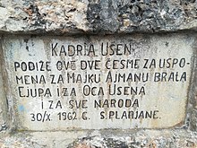
Planjane
| |
|---|---|
Village | |
| Coordinates: 42°10′42″N 20°50′24″E / 42.178333°N 20.84°E | |
| Location | |
| District | Prizren |
| Municipality | Prizren |
| Population (2011)
[1] | |
| • Total | 1,104 |
| Time zone | UTC+1 ( CET) |
| • Summer ( DST) | UTC+2 ( CEST) |
Planjane ( Serbian Cyrillic: Плањане; Albanian: Pllanjanë; Bosnian: Planjane) is a village near Rečane and Brezovica, Kosovo. [2]

Planjane is located in the historical region of Sredačka župa, a medieval župa (small administrative division) within, now part of southeastern Kosovo. It encompassed seven hamlets and was centered in the town of Sredska. [3]
The village is inhabited by Bosniaks. [4]
- Alen Azari, politician from the Nova Demokratska Stranka party
- ^ 2011 Kosovo Census results
- ^ "NGA GEOnet Names Server". National Geospatial-Intelligence Agency. 2008-01-30. Archived from the original on 2003-10-08. Retrieved 2008-01-31.
- ^ Radovanović, Milovan. Шар планина и њене жупе у косовско-метохијској области јужне Србије (PDF) (in Serbian). Retrieved 5 December 2010.
- ^ "The ICO Special Projects Fund" (PDF). ICO KOS. Archived from the original (PDF) on 17 August 2011.
Planjane
| |
|---|---|
Village | |
| Coordinates: 42°10′42″N 20°50′24″E / 42.178333°N 20.84°E | |
| Location | |
| District | Prizren |
| Municipality | Prizren |
| Population (2011)
[1] | |
| • Total | 1,104 |
| Time zone | UTC+1 ( CET) |
| • Summer ( DST) | UTC+2 ( CEST) |
Planjane ( Serbian Cyrillic: Плањане; Albanian: Pllanjanë; Bosnian: Planjane) is a village near Rečane and Brezovica, Kosovo. [2]

Planjane is located in the historical region of Sredačka župa, a medieval župa (small administrative division) within, now part of southeastern Kosovo. It encompassed seven hamlets and was centered in the town of Sredska. [3]
The village is inhabited by Bosniaks. [4]
- Alen Azari, politician from the Nova Demokratska Stranka party
- ^ 2011 Kosovo Census results
- ^ "NGA GEOnet Names Server". National Geospatial-Intelligence Agency. 2008-01-30. Archived from the original on 2003-10-08. Retrieved 2008-01-31.
- ^ Radovanović, Milovan. Шар планина и њене жупе у косовско-метохијској области јужне Србије (PDF) (in Serbian). Retrieved 5 December 2010.
- ^ "The ICO Special Projects Fund" (PDF). ICO KOS. Archived from the original (PDF) on 17 August 2011.
