Pleasant Valley Township | |
|---|---|
 Location in Decatur County | |
| Coordinates: 39°42′00″N 100°13′01″W / 39.70000°N 100.21694°W | |
| Country | United States |
| State | Kansas |
| County | Decatur |
| Area | |
| • Total | 35.79 sq mi (92.69 km2) |
| • Land | 35.77 sq mi (92.65 km2) |
| • Water | 0.02 sq mi (0.05 km2) 0.05% |
| Elevation | 2,461 ft (750 m) |
| Population (
2000) | |
| • Total | 46 |
| • Density | 1.3/sq mi (0.5/km2) |
| GNIS feature ID | 0471078 |
Pleasant Valley Township is a township in Decatur County, Kansas, USA. As of the 2000 census, its population was 46.
Geography
Pleasant Valley Township covers an area of 35.79 square miles (92.7 km2) and contains no incorporated settlements.
The stream of Big Timber Creek runs through this township.
References
External links
Municipalities and communities of
Decatur County, Kansas, United States | ||
|---|---|---|
| Cities | 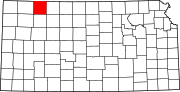 | |
|
Unincorporated communities | ||
| Ghost towns | ||
| Townships | ||
| Footnotes | ‡This community also has portions in an adjacent county or counties. | |
|
| This article about a location in Decatur County, Kansas is a stub. You can help Wikipedia by expanding it. |
Pleasant Valley Township | |
|---|---|
|
Location in Decatur County | |
| Coordinates: 39°42′00″N 100°13′01″W / 39.70000°N 100.21694°W | |
| Country | United States |
| State | Kansas |
| County | Decatur |
| Area | |
| • Total | 35.79 sq mi (92.69 km2) |
| • Land | 35.77 sq mi (92.65 km2) |
| • Water | 0.02 sq mi (0.05 km2) 0.05% |
| Elevation | 2,461 ft (750 m) |
| Population (
2000) | |
| • Total | 46 |
| • Density | 1.3/sq mi (0.5/km2) |
| GNIS feature ID | 0471078 |
Pleasant Valley Township is a township in Decatur County, Kansas, USA. As of the 2000 census, its population was 46.
Geography
Pleasant Valley Township covers an area of 35.79 square miles (92.7 km2) and contains no incorporated settlements.
The stream of Big Timber Creek runs through this township.
References
External links
Municipalities and communities of
Decatur County, Kansas, United States | ||
|---|---|---|
| Cities | | |
|
Unincorporated communities | ||
| Ghost towns | ||
| Townships | ||
| Footnotes | ‡This community also has portions in an adjacent county or counties. | |
|
| This article about a location in Decatur County, Kansas is a stub. You can help Wikipedia by expanding it. |