Pine Level | |
|---|---|
 | |
 Pine Level | |
| Coordinates: 32°35′01″N 86°27′56″W / 32.58361°N 86.46556°W | |
| Country | United States |
| State | Alabama |
| County | Autauga |
| Incorporated | 2023 |
| Government | |
| • Type | Mayor-council |
| • Mayor | Zachary Bigley |
| Area CDP
[1] | |
| • Total | 25.22 sq mi (65.33 km2) |
| • Land | 25.17 sq mi (65.20 km2) |
| • Water | 0.05 sq mi (0.13 km2) |
| Elevation | 574 ft (175 m) |
| Population (CDP
2020) | |
| • Total | 4,885 |
| • Density | 194.05/sq mi (74.92/km2) |
| Time zone | UTC-6 ( Central (CST)) |
| • Summer ( DST) | UTC-5 (CDT) |
| ZIP code | CDP includes 36067,36066,36022 |
| Area code | 334 |
| GNIS feature ID | 124826 [2] |
Pine Level is a town and former census-designated place (CDP) in Autauga County, Alabama, north of Prattville and west of Deatsville. As of the 2010 census, the CDP's population was 4,183. [3] The town is part of the Montgomery Metropolitan Statistical Area.
Geography
The town is located along U.S. Route 31, 18 mi (29 km) northwest of Montgomery and 77 mi (124 km) south of Birmingham, both via I-65. The Town's current boundaries center on the U.S. Route 31 and Autauga County Roads 40 and 107 vicinity.
The Town is located just south of a large (approximately 2 square mile) geographic flat in an otherwise moderately hilly region that gave the area and community its name.
History
From 1941-1945, the large flat area adjacent to town was home to the Deatsville Auxiliary Field, an auxiliary Air Corps/Army Air Force pilot training air field associated with Gunter Field in Montgomery, Alabama. After WWII it was converted back to farmland.
The community of Pine Level held a local referendum on September 26, 2023. [4] [5] [6] Of the 300-plus eligible voters in the Pine Level community, 59 voted for incorporation and 43 voted against. The ballots were tallied at the Autauga County Probate Office that evening. The outcome came after more than a year of work and campaigning. Residents who favored incorporation stated that the establishment of a town would help keep tax dollars local and prevent another municipality from annexing Pine Level. A census of the residents located within the town's proposed boundaries was subsequently conducted before municipal elections were ordered to be held on December 5, 2023. [7] On that day, the inaugural mayor and five at-large town council members were elected. Mayor Zachary Bigley and the five council members were all were sworn into office on December 11, 2023. [8]
Education
Pine Level CDP is home to Pine Level Elementary School and Marbury High School, part of the Autauga County School System. Both schools are located outside of the Town's official boundaries.
Emergency Services
Fire protection is provided by the Pine Level Fire Department.
Emergency Medical Services are provided by Haynes Ambulance.
Law enforcement agency is the Autauga County Sheriffs Office.
Demographics
| Census | Pop. | Note | %± |
|---|---|---|---|
| 2010 | 4,183 | — | |
| 2020 | 4,885 | 16.8% | |
| U.S. Decennial Census
[9] 1850-1870 [10] 1870-1880 [11] 1890-1910 [12] 1920 [13] 1930 [14] 1940 [15] 1950 [16] 1960 [17] 1970 [18] 1980 [19] 1990 [20] 2000 [21] 2010 [22] 2020 [23] | |||
Pine level was first listed as a census designated place in the 2010 U.S. Census. [22] [21]
| Race / Ethnicity (NH = Non-Hispanic) | Pop 2010 [24] | Pop 2020 [23] | % 2010 | % 2020 |
|---|---|---|---|---|
| White alone (NH) | 3,813 | 4,251 | 91.15% | 87.02% |
| Black or African American alone (NH) | 191 | 321 | 4.57% | 6.57% |
| Native American or Alaska Native alone (NH) | 9 | 12 | 0.22% | 0.25% |
| Asian alone (NH) | 19 | 10 | 0.45% | 0.20% |
| Pacific Islander alone (NH) | 4 | 0 | 0.10% | 0.00% |
| Some Other Race alone (NH) | 5 | 3 | 0.12% | 0.06% |
| Mixed Race or Multi-Racial (NH) | 70 | 183 | 1.67% | 3.75% |
| Hispanic or Latino (any race) | 72 | 105 | 1.72% | 2.15% |
| Total | 4,183 | 4,885 | 100.00% | 100.00% |
References
- ^ "2020 U.S. Gazetteer Files". United States Census Bureau. Retrieved October 29, 2021.
- ^ "Pine Level". Geographic Names Information System. United States Geological Survey, United States Department of the Interior.
- ^ "U.S. Census website". United States Census Bureau. Retrieved May 14, 2011.
- ^ https://www.montgomeryadvertiser.com/story/news/local/progress/2023/09/26/by-16-votes-pine-level-chooses-to-become-a-town/70965735007/, authored by Marty Roney, Montgomery Advertiser
- ^ https://www.wsfa.com/2023/09/27/pine-level-votes-become-town/, authored by Brady Talbert, WSFA News Staff
- ^ https://www.waka.com/2023/09/27/pine-level-residents-vote-to-incorporate-community-into-town/, authored by Teresa Lawson, WAKA Action News
- ^ https://www.facebook.com/PineLevelAl/, Town of Pine Level's Facebook page
- ^ Town of Pine Level's Facebook page
- ^ "Decennial Census of Population and Housing by Decade". United States Census Bureau.
- ^ "1870 Census of Population - Alabama - Population of Civil Divisions less than Counties" (PDF). United States Census Bureau. 1870.
- ^ "1880 Census of Population - Alabama - Population of Civil Divisions less than Counties" (PDF). United States Census Bureau. 1880.
- ^ "1910 Census of Population - Alabama" (PDF). United States Census Bureau. 1910.
- ^ "1920 Census of Population - Alabama" (PDF). United States Census Bureau. 1920. pp. 178–179.
- ^ "1930 Census of Population - Alabama" (PDF). United States Census Bureau. 1930. p. 139.
- ^ "1940 Census of Population - Alabama" (PDF). United States Census Bureau. 1940.
- ^ "1950 Census of Population - Alabama" (PDF). United States Census Bureau. 1950.
- ^ "1960 Census of Population - Population of all incorporated places; and all unincorporated places of 1,000 or more - Alabama" (PDF). United States Census Bureau. 1960.
- ^ "1970 Census of Population - Alabama" (PDF). United States Census Bureau. 1970.
- ^ "1980 Census of Population - Alabama" (PDF). United States Census Bureau. 1980.
- ^ "1990 Census of Population - Alabama" (PDF). United States Census Bureau. 1990.
- ^ a b "2000 Census of Population - Summary Population and Housing Characteristics - Alabama" (PDF). United States Census Bureau. 2000.
- ^ a b "2010 Census of Population - General Population Characteristics - Alabama" (PDF). United States Census Bureau. 2010.
- ^ a b "P2 Hispanic or Latino, and Not Hispanic or Latino by Race – 2020: DEC Redistricting Data (PL 94-171) – Pine Level CDP, Autauga County, Alabama". United States Census Bureau.
- ^ "P2 Hispanic or Latino, and Not Hispanic or Latino by Race – 2010: DEC Redistricting Data (PL 94-171) – Pine Level CDP, Autauga County, Alabama". United States Census Bureau.
External links
Municipalities and communities of
Autauga County, Alabama, United States | ||
|---|---|---|
| Cities | 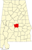 | |
| Towns | ||
| CDPs | ||
|
Unincorporated communities | ||
| Ghost town | ||
| Footnotes | ‡This populated place also has portions in an adjacent county or counties | |
|
| This Autauga County, Alabama state location article is a stub. You can help Wikipedia by expanding it. |
Pine Level | |
|---|---|
|
| |
Pine Level | |
| Coordinates: 32°35′01″N 86°27′56″W / 32.58361°N 86.46556°W | |
| Country | United States |
| State | Alabama |
| County | Autauga |
| Incorporated | 2023 |
| Government | |
| • Type | Mayor-council |
| • Mayor | Zachary Bigley |
| Area CDP
[1] | |
| • Total | 25.22 sq mi (65.33 km2) |
| • Land | 25.17 sq mi (65.20 km2) |
| • Water | 0.05 sq mi (0.13 km2) |
| Elevation | 574 ft (175 m) |
| Population (CDP
2020) | |
| • Total | 4,885 |
| • Density | 194.05/sq mi (74.92/km2) |
| Time zone | UTC-6 ( Central (CST)) |
| • Summer ( DST) | UTC-5 (CDT) |
| ZIP code | CDP includes 36067,36066,36022 |
| Area code | 334 |
| GNIS feature ID | 124826 [2] |
Pine Level is a town and former census-designated place (CDP) in Autauga County, Alabama, north of Prattville and west of Deatsville. As of the 2010 census, the CDP's population was 4,183. [3] The town is part of the Montgomery Metropolitan Statistical Area.
Geography
The town is located along U.S. Route 31, 18 mi (29 km) northwest of Montgomery and 77 mi (124 km) south of Birmingham, both via I-65. The Town's current boundaries center on the U.S. Route 31 and Autauga County Roads 40 and 107 vicinity.
The Town is located just south of a large (approximately 2 square mile) geographic flat in an otherwise moderately hilly region that gave the area and community its name.
History
From 1941-1945, the large flat area adjacent to town was home to the Deatsville Auxiliary Field, an auxiliary Air Corps/Army Air Force pilot training air field associated with Gunter Field in Montgomery, Alabama. After WWII it was converted back to farmland.
The community of Pine Level held a local referendum on September 26, 2023. [4] [5] [6] Of the 300-plus eligible voters in the Pine Level community, 59 voted for incorporation and 43 voted against. The ballots were tallied at the Autauga County Probate Office that evening. The outcome came after more than a year of work and campaigning. Residents who favored incorporation stated that the establishment of a town would help keep tax dollars local and prevent another municipality from annexing Pine Level. A census of the residents located within the town's proposed boundaries was subsequently conducted before municipal elections were ordered to be held on December 5, 2023. [7] On that day, the inaugural mayor and five at-large town council members were elected. Mayor Zachary Bigley and the five council members were all were sworn into office on December 11, 2023. [8]
Education
Pine Level CDP is home to Pine Level Elementary School and Marbury High School, part of the Autauga County School System. Both schools are located outside of the Town's official boundaries.
Emergency Services
Fire protection is provided by the Pine Level Fire Department.
Emergency Medical Services are provided by Haynes Ambulance.
Law enforcement agency is the Autauga County Sheriffs Office.
Demographics
| Census | Pop. | Note | %± |
|---|---|---|---|
| 2010 | 4,183 | — | |
| 2020 | 4,885 | 16.8% | |
| U.S. Decennial Census
[9] 1850-1870 [10] 1870-1880 [11] 1890-1910 [12] 1920 [13] 1930 [14] 1940 [15] 1950 [16] 1960 [17] 1970 [18] 1980 [19] 1990 [20] 2000 [21] 2010 [22] 2020 [23] | |||
Pine level was first listed as a census designated place in the 2010 U.S. Census. [22] [21]
| Race / Ethnicity (NH = Non-Hispanic) | Pop 2010 [24] | Pop 2020 [23] | % 2010 | % 2020 |
|---|---|---|---|---|
| White alone (NH) | 3,813 | 4,251 | 91.15% | 87.02% |
| Black or African American alone (NH) | 191 | 321 | 4.57% | 6.57% |
| Native American or Alaska Native alone (NH) | 9 | 12 | 0.22% | 0.25% |
| Asian alone (NH) | 19 | 10 | 0.45% | 0.20% |
| Pacific Islander alone (NH) | 4 | 0 | 0.10% | 0.00% |
| Some Other Race alone (NH) | 5 | 3 | 0.12% | 0.06% |
| Mixed Race or Multi-Racial (NH) | 70 | 183 | 1.67% | 3.75% |
| Hispanic or Latino (any race) | 72 | 105 | 1.72% | 2.15% |
| Total | 4,183 | 4,885 | 100.00% | 100.00% |
References
- ^ "2020 U.S. Gazetteer Files". United States Census Bureau. Retrieved October 29, 2021.
- ^ "Pine Level". Geographic Names Information System. United States Geological Survey, United States Department of the Interior.
- ^ "U.S. Census website". United States Census Bureau. Retrieved May 14, 2011.
- ^ https://www.montgomeryadvertiser.com/story/news/local/progress/2023/09/26/by-16-votes-pine-level-chooses-to-become-a-town/70965735007/, authored by Marty Roney, Montgomery Advertiser
- ^ https://www.wsfa.com/2023/09/27/pine-level-votes-become-town/, authored by Brady Talbert, WSFA News Staff
- ^ https://www.waka.com/2023/09/27/pine-level-residents-vote-to-incorporate-community-into-town/, authored by Teresa Lawson, WAKA Action News
- ^ https://www.facebook.com/PineLevelAl/, Town of Pine Level's Facebook page
- ^ Town of Pine Level's Facebook page
- ^ "Decennial Census of Population and Housing by Decade". United States Census Bureau.
- ^ "1870 Census of Population - Alabama - Population of Civil Divisions less than Counties" (PDF). United States Census Bureau. 1870.
- ^ "1880 Census of Population - Alabama - Population of Civil Divisions less than Counties" (PDF). United States Census Bureau. 1880.
- ^ "1910 Census of Population - Alabama" (PDF). United States Census Bureau. 1910.
- ^ "1920 Census of Population - Alabama" (PDF). United States Census Bureau. 1920. pp. 178–179.
- ^ "1930 Census of Population - Alabama" (PDF). United States Census Bureau. 1930. p. 139.
- ^ "1940 Census of Population - Alabama" (PDF). United States Census Bureau. 1940.
- ^ "1950 Census of Population - Alabama" (PDF). United States Census Bureau. 1950.
- ^ "1960 Census of Population - Population of all incorporated places; and all unincorporated places of 1,000 or more - Alabama" (PDF). United States Census Bureau. 1960.
- ^ "1970 Census of Population - Alabama" (PDF). United States Census Bureau. 1970.
- ^ "1980 Census of Population - Alabama" (PDF). United States Census Bureau. 1980.
- ^ "1990 Census of Population - Alabama" (PDF). United States Census Bureau. 1990.
- ^ a b "2000 Census of Population - Summary Population and Housing Characteristics - Alabama" (PDF). United States Census Bureau. 2000.
- ^ a b "2010 Census of Population - General Population Characteristics - Alabama" (PDF). United States Census Bureau. 2010.
- ^ a b "P2 Hispanic or Latino, and Not Hispanic or Latino by Race – 2020: DEC Redistricting Data (PL 94-171) – Pine Level CDP, Autauga County, Alabama". United States Census Bureau.
- ^ "P2 Hispanic or Latino, and Not Hispanic or Latino by Race – 2010: DEC Redistricting Data (PL 94-171) – Pine Level CDP, Autauga County, Alabama". United States Census Bureau.
External links
Municipalities and communities of
Autauga County, Alabama, United States | ||
|---|---|---|
| Cities | | |
| Towns | ||
| CDPs | ||
|
Unincorporated communities | ||
| Ghost town | ||
| Footnotes | ‡This populated place also has portions in an adjacent county or counties | |
|
| This Autauga County, Alabama state location article is a stub. You can help Wikipedia by expanding it. |