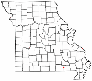
Pine is a small unincorporated community in western Ripley County, Missouri, United States. It is located on a county road in the Mark Twain National Forest, approximately sixteen miles northwest of Doniphan.
A post office called Pine was established in 1883, and remained in operation until the 1970s. [1] The community was so named on account of pine trees near the original town site. [2]
References
- ^ "Post Offices". Jim Forte Postal History. Retrieved December 14, 2016.
- ^ "Ripley County Place Names, 1928–1945". The State Historical Society of Missouri. Archived from the original on June 24, 2016. Retrieved December 14, 2016.
36°42′58″N 91°05′42″W / 36.716°N 91.095°W
