Photos • Location
Pencuke Farm


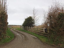
Pencuke is a hamlet near Higher Crackington in northeast Cornwall, England, UK. [1] [2]
- ^ Ordnance Survey: Landranger map sheet 190 Bude & Clovelly (Boscastle & Holsworthy) (Map). Ordnance Survey. 2014. ISBN 9780319231456.
- ^ Philip's Street Atlas Cornwall. London: Philip's, 2003; p. 10
| Unitary authorities | |
|---|---|
| Major settlements (cities in italics) |
|
| Rivers | |
| Topics | |
50°43′12″N 4°36′07″W / 50.720°N 4.602°W
|
| This Cornwall location article is a stub. You can help Wikipedia by expanding it. |