This article needs additional citations for
verification. (April 2019) |
Parutyne
Парутине | |
|---|---|
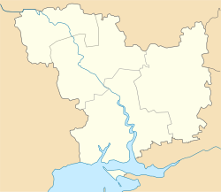
| Coordinates: 46°42′23″N 31°53′48″E / 46.70639°N 31.89667°E | |
| Country | |
| Region | Mykolaiv Oblast |
| Raion | Mykolaiv Raion |
| Administrative Classification | KOATUU: 4825182801 |
| Founded | 1789 |
| Area | |
| • Total | 2.17 km2 (0.84 sq mi) |
| Elevation | 24 m (79 ft) |
| Population | |
| • Total | 1,996 |
| • Density | 919.82/km2 (2,382.3/sq mi) |
| Time zone | UTC+2 (EET) |
| • Summer ( DST) | UTC+3 (EEST) |
| Postal code | 57540 |
| Area code | +380 5154 |
|
| |
Parutyne ( Ukrainian: Парутине) is a village of Mykolaiv Raion, Mykolaiv Oblast, in Southern Ukraine. The village is a center of local rural community ("silrada").
On territory of the village are located ruins of the Ancient Greek polis Olbia.
The settlement was founded in 1789 at Parutyne balka ( gulch) near location known "Sta Mohyl" (Hundreds burials) by former Nekrasov Cossacks– Lipovans who resettled here from Cioburciu (Chobruchi). [1]
Following the Siege of Ochakov during the 1787–1792 Russo-Turkish War, in 1792 over 12,000 desiatinas (~32.5 thousands of acres) of land with Parutyne at the right bank of Boh liman ( Southern Bug estuary) near Ochakiv were given by Catherine the Great to " Malorossian" landowner and son of former Cossack Hetmanate official, Count Illia Bezborodko. [1]
After that Nekrassov Cossacks left Parutyne and returned to Dniester banks, while Bezborodko resettled the area with own serfs primarily from Chernigov Governorate (former Cossack Hetmanate). [1] The settlement was renamed as Ilyinske. [1] During the 1795 revision in Ilyinske lived 324 males. [1] At first the village belonged to Kherson county of Novorossiysk Governorate, and since 1827 to Odessa county of Kherson Governorate. [1] In 1858 Ilyinske is mentioned in historical sources as a town (miestechko) which accounted for over 100 households (dvory - courts) with 864 serfs. [1]


