Parkent | |
|---|---|
| Parkent tumani | |
 | |
| Country | Uzbekistan |
| Region | Tashkent Region |
| Capital | Parkent |
| Established | 1926 |
| Area | |
| • Total | 1,080 km2 (420 sq mi) |
| Population (2021) | |
| • Total | 157,500 |
| • Density | 150/km2 (380/sq mi) |
| Time zone | UTC+5 ( UZT) |
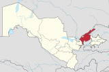
Parkent is a district of Tashkent Region in Uzbekistan. The capital lies at the city Parkent. [1] It has an area of 1,080 km2 (420 sq mi) [2] and it had 157,500 inhabitants in 2021. [3] The district consists of one city ( Parkent), 3 urban-type settlements (Quyosh, Qoʻrgʻontepa, Chinorli) and 9 rural communities (Zarkent, Qoraqalpoq, Boʻston Chotqol 37-maktab , Nomdanak, Parkent, Soʻqoq, Xisarak, Boshqizilsoy, Changi). [1]
- ^ a b "Classification system of territorial units of the Republic of Uzbekistan" (in Uzbek and Russian). The State Committee of the Republic of Uzbekistan on statistics. July 2020.
- ^ "Toshkent viloyatining ma'muriy-hududiy bo'linishi" [Administrative-territorial division of the Tashkent Region] (PDF) (in Uzbek). Tashkent regional department of statistics.
- ^ "Urban and rural population by district" (PDF) (in Uzbek). Tashkent regional department of statistics.
41°17′36″N 69°40′51″E / 41.2933°N 69.6808°E
-
Parkent | |
|---|---|
| Parkent tumani | |
 | |
| Country | Uzbekistan |
| Region | Tashkent Region |
| Capital | Parkent |
| Established | 1926 |
| Area | |
| • Total | 1,080 km2 (420 sq mi) |
| Population (2021) | |
| • Total | 157,500 |
| • Density | 150/km2 (380/sq mi) |
| Time zone | UTC+5 ( UZT) |
Parkent is a district of Tashkent Region in Uzbekistan. The capital lies at the city Parkent. [1] It has an area of 1,080 km2 (420 sq mi) [2] and it had 157,500 inhabitants in 2021. [3] The district consists of one city ( Parkent), 3 urban-type settlements (Quyosh, Qoʻrgʻontepa, Chinorli) and 9 rural communities (Zarkent, Qoraqalpoq, Boʻston Chotqol 37-maktab , Nomdanak, Parkent, Soʻqoq, Xisarak, Boshqizilsoy, Changi). [1]
- ^ a b "Classification system of territorial units of the Republic of Uzbekistan" (in Uzbek and Russian). The State Committee of the Republic of Uzbekistan on statistics. July 2020.
- ^ "Toshkent viloyatining ma'muriy-hududiy bo'linishi" [Administrative-territorial division of the Tashkent Region] (PDF) (in Uzbek). Tashkent regional department of statistics.
- ^ "Urban and rural population by district" (PDF) (in Uzbek). Tashkent regional department of statistics.
41°17′36″N 69°40′51″E / 41.2933°N 69.6808°E
-
