Paoli, Colorado | |
|---|---|
 Entering Paoli from the west on
U.S. Route 6, February 2013 | |
 Location of Paoli in Phillips County, Colorado. | |
| Coordinates: 40°36′44″N 102°28′22″W / 40.61222°N 102.47278°W | |
| Country | |
| State | |
| County [1] | Phillips |
| Incorporated | 1930-08-06 [2] |
| Named for | Pasquale Paoli |
| Government | |
| • Type | Statutory Town [1] |
| Area | |
| • Total | 0.30 sq mi (0.77 km2) |
| • Land | 0.30 sq mi (0.77 km2) |
| • Water | 0.00 sq mi (0.00 km2) |
| Elevation | 3,888 ft (1,185 m) |
| Population | |
| • Total | 51 |
| • Density | 170/sq mi (66/km2) |
| Time zone | UTC-7 ( MST) |
| • Summer ( DST) | UTC-6 ( MDT) |
| ZIP code [6] | 80746 (
PO Box) |
| Area code | 970 |
| FIPS code | 08-57245 |
| GNIS feature ID | 0182821 |
Fifth least populous Colorado municipality | |
Paoli is a Statutory Town in Phillips County, Colorado, United States. The population was 51 according to the 2020 census. [5]
Description
A post office called Paoli has been in operation since 1888. [7] The community was named after Paoli, Pennsylvania. [8]
Geography
Paoli is located at 40°36′44″N 102°28′22″W / 40.61222°N 102.47278°W (40.612120, -102.472868). [9]
According to the United States Census Bureau, the town has a total area of 0.3 square miles (0.78 km2), all of it land.
Demographics
| Census | Pop. | Note | %± |
|---|---|---|---|
| 1940 | 85 | — | |
| 1950 | 91 | 7.1% | |
| 1960 | 81 | −11.0% | |
| 1970 | 52 | −35.8% | |
| 1980 | 81 | 55.8% | |
| 1990 | 29 | −64.2% | |
| 2000 | 42 | 44.8% | |
| 2010 | 34 | −19.0% | |
| 2020 | 51 | 50.0% | |
| U.S. Decennial Census | |||
See also
References
- ^ a b "Active Colorado Municipalities". State of Colorado, Department of Local Affairs. Archived from the original on December 12, 2009. Retrieved September 1, 2007.
- ^ "Colorado Municipal Incorporations". State of Colorado, Department of Personnel & Administration, Colorado State Archives. December 1, 2004. Retrieved November 30, 2007.
- ^ "2019 U.S. Gazetteer Files". United States Census Bureau. Retrieved July 1, 2020.
- ^ "US Board on Geographic Names". United States Geological Survey. October 25, 2007. Retrieved January 31, 2008.
- ^ a b United States Census Bureau. "Paoli town; Colorado". Retrieved April 21, 2023.
- ^ "ZIP Code Lookup". United States Postal Service. Archived from the original ( JavaScript/ HTML) on January 1, 2008. Retrieved December 2, 2007.
- ^ "Post offices". Jim Forte Postal History. Retrieved July 6, 2016.
- ^ Dawson, John Frank. Place names in Colorado: why 700 communities were so named, 150 of Spanish or Indian origin. Denver, CO: The J. Frank Dawson Publishing Co. p. 39.
- ^ "US Gazetteer files: 2010, 2000, and 1990". United States Census Bureau. February 12, 2011. Retrieved April 23, 2011.
External links
Municipalities and communities of
Phillips County, Colorado, United States | ||
|---|---|---|
| City | 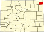 | |
| Towns | ||
| CDP | ||
Paoli, Colorado | |
|---|---|
|
Entering Paoli from the west on
U.S. Route 6, February 2013 | |
|
Location of Paoli in Phillips County, Colorado. | |
| Coordinates: 40°36′44″N 102°28′22″W / 40.61222°N 102.47278°W | |
| Country | |
| State | |
| County [1] | Phillips |
| Incorporated | 1930-08-06 [2] |
| Named for | Pasquale Paoli |
| Government | |
| • Type | Statutory Town [1] |
| Area | |
| • Total | 0.30 sq mi (0.77 km2) |
| • Land | 0.30 sq mi (0.77 km2) |
| • Water | 0.00 sq mi (0.00 km2) |
| Elevation | 3,888 ft (1,185 m) |
| Population | |
| • Total | 51 |
| • Density | 170/sq mi (66/km2) |
| Time zone | UTC-7 ( MST) |
| • Summer ( DST) | UTC-6 ( MDT) |
| ZIP code [6] | 80746 (
PO Box) |
| Area code | 970 |
| FIPS code | 08-57245 |
| GNIS feature ID | 0182821 |
Fifth least populous Colorado municipality | |
Paoli is a Statutory Town in Phillips County, Colorado, United States. The population was 51 according to the 2020 census. [5]
Description
A post office called Paoli has been in operation since 1888. [7] The community was named after Paoli, Pennsylvania. [8]
Geography
Paoli is located at 40°36′44″N 102°28′22″W / 40.61222°N 102.47278°W (40.612120, -102.472868). [9]
According to the United States Census Bureau, the town has a total area of 0.3 square miles (0.78 km2), all of it land.
Demographics
| Census | Pop. | Note | %± |
|---|---|---|---|
| 1940 | 85 | — | |
| 1950 | 91 | 7.1% | |
| 1960 | 81 | −11.0% | |
| 1970 | 52 | −35.8% | |
| 1980 | 81 | 55.8% | |
| 1990 | 29 | −64.2% | |
| 2000 | 42 | 44.8% | |
| 2010 | 34 | −19.0% | |
| 2020 | 51 | 50.0% | |
| U.S. Decennial Census | |||
See also
References
- ^ a b "Active Colorado Municipalities". State of Colorado, Department of Local Affairs. Archived from the original on December 12, 2009. Retrieved September 1, 2007.
- ^ "Colorado Municipal Incorporations". State of Colorado, Department of Personnel & Administration, Colorado State Archives. December 1, 2004. Retrieved November 30, 2007.
- ^ "2019 U.S. Gazetteer Files". United States Census Bureau. Retrieved July 1, 2020.
- ^ "US Board on Geographic Names". United States Geological Survey. October 25, 2007. Retrieved January 31, 2008.
- ^ a b United States Census Bureau. "Paoli town; Colorado". Retrieved April 21, 2023.
- ^ "ZIP Code Lookup". United States Postal Service. Archived from the original ( JavaScript/ HTML) on January 1, 2008. Retrieved December 2, 2007.
- ^ "Post offices". Jim Forte Postal History. Retrieved July 6, 2016.
- ^ Dawson, John Frank. Place names in Colorado: why 700 communities were so named, 150 of Spanish or Indian origin. Denver, CO: The J. Frank Dawson Publishing Co. p. 39.
- ^ "US Gazetteer files: 2010, 2000, and 1990". United States Census Bureau. February 12, 2011. Retrieved April 23, 2011.
External links
Municipalities and communities of
Phillips County, Colorado, United States | ||
|---|---|---|
| City | | |
| Towns | ||
| CDP | ||