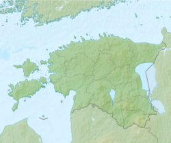
Photos • Location
This article needs additional citations for
verification. (January 2021) |
Panga | |
|---|---|
Village | |
| Coordinates: 58°49′49″N 23°34′51″E / 58.8303389°N 23.5807099°E | |
| Country | |
| County | Lääne County |
| Municipality | Haapsalu |
| Population | |
| • Total | 290 |
| Time zone | UTC+2 ( EET) |
| • Summer ( DST) | UTC+3 ( EEST) |
Panga is a village in Haapsalu municipality, Lääne County, in western Estonia. [1] Prior to the 2017 administrative reform of local governments, it was located in Ridala Parish.
There is basic school (Ridala põhikool). [2]
References
- ^ Classification of Estonian administrative units and settlements 2014[ dead link] (retrieved 28 July 2021)
- ^ http://www.ridala.edu.ee/wp/ (accessed 24 February 2020)
58°49′32″N 23°34′01″E / 58.82556°N 23.56694°E


