12°23′56″S 74°52′0″W / 12.39889°S 74.86667°W
You can help expand this article with text translated from
the corresponding article in Spanish. (February 2009) Click [show] for important translation instructions.
|
Pampas | |
|---|---|
 Plaza de Armas, Pampas | |
 Flag  Coat of arms | |
| Nickname: Ciudad de los Cuchimichis (The Cuchimichis City) | |
 Pampas | |
| Coordinates: 12°23′55.76″S 74°52′12.78″W / 12.3988222°S 74.8702167°W | |
| Country | Peru |
| Region | Huancavelica |
| Province | Tayacaja |
| Established | 21 June 1825 |
| Government | |
| • Mayor | Jess Amrico Monge Abad |
| Area | |
| • Total | 52.264 km2 (20.179 sq mi) |
| Elevation | 3,276 m (10,748 ft) |
| Population | |
| • Total | 11,566 |
| • Density | 221.3/km2 (573/sq mi) |
| Time zone | UTC-5 (PET) |
| • Summer ( DST) | UTC-5 (PET) |
| Area code | 067 |
| Website | www.munitayacaja.gob.pe |
Pampas is a city in Peru. It is the capital of the Tayacaja Province and it was established on June 21, 1825. According to the 2007 census had a population of 9,973 (11,566 in the metropolitan area). [1] It has an approximate altitude of 3,276 metres.
Transportation
The city is connected to the nearby cities like Huancayo and Ayacucho by partially paved roads.[ citation needed]
Education
The city house a branch of the Universidad Nacional de Huancavelica and it is home of a local technical institute; the Instituto Tecnologico Pampas - Tayacaja.[ citation needed]
Health
The city has now a new hospital, the Hospital Pampas that serve the city and the towns nearby.[ citation needed]
Images
-
 A house in Pampas.
 -
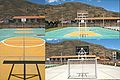 Futsal court in Pampas.
 -
 Slide in the "Parque Ecolgico de Pampas".
 -
 Gardens in the "Parque Ecolgico de Pampas".
 -
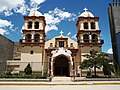 Cathedral of San Pedro de Pampas.
 -
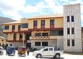 Municipality of Pampas.
 -
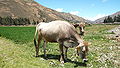 A cow in Pampas.
 -
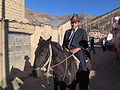 Pampino.


References
-
^
Instituto Nacional de Estadstica e Informtica (2007).
"Censos Nacionales 2007: XI de Poblacin y VI de Vivienda" (in Spanish). Archived from
the original on May 5, 2012. Retrieved November 12, 2008.
Statistics taken of the agglomeration from Acraquia (799), Ahuaycha (794), Daniel Hernndez (3.946) and Pampas (6.027)
External links
| International | |
|---|---|
| National | |
12°23′56″S 74°52′0″W / 12.39889°S 74.86667°W
You can help expand this article with text translated from
the corresponding article in Spanish. (February 2009) Click [show] for important translation instructions.
|
Pampas | |
|---|---|
|
Plaza de Armas, Pampas | |
|
Flag Coat of arms | |
| Nickname: Ciudad de los Cuchimichis (The Cuchimichis City) | |
Pampas | |
| Coordinates: 12°23′55.76″S 74°52′12.78″W / 12.3988222°S 74.8702167°W | |
| Country | Peru |
| Region | Huancavelica |
| Province | Tayacaja |
| Established | 21 June 1825 |
| Government | |
| • Mayor | Jess Amrico Monge Abad |
| Area | |
| • Total | 52.264 km2 (20.179 sq mi) |
| Elevation | 3,276 m (10,748 ft) |
| Population | |
| • Total | 11,566 |
| • Density | 221.3/km2 (573/sq mi) |
| Time zone | UTC-5 (PET) |
| • Summer ( DST) | UTC-5 (PET) |
| Area code | 067 |
| Website | www.munitayacaja.gob.pe |
Pampas is a city in Peru. It is the capital of the Tayacaja Province and it was established on June 21, 1825. According to the 2007 census had a population of 9,973 (11,566 in the metropolitan area). [1] It has an approximate altitude of 3,276 metres.
Transportation
The city is connected to the nearby cities like Huancayo and Ayacucho by partially paved roads.[ citation needed]
Education
The city house a branch of the Universidad Nacional de Huancavelica and it is home of a local technical institute; the Instituto Tecnologico Pampas - Tayacaja.[ citation needed]
Health
The city has now a new hospital, the Hospital Pampas that serve the city and the towns nearby.[ citation needed]
Images
-
A house in Pampas.
-
Futsal court in Pampas.
-
Slide in the "Parque Ecolgico de Pampas".
-
Gardens in the "Parque Ecolgico de Pampas".
-
Cathedral of San Pedro de Pampas.
-
Municipality of Pampas.
-
A cow in Pampas.
-
Pampino.
References
-
^
Instituto Nacional de Estadstica e Informtica (2007).
"Censos Nacionales 2007: XI de Poblacin y VI de Vivienda" (in Spanish). Archived from
the original on May 5, 2012. Retrieved November 12, 2008.
Statistics taken of the agglomeration from Acraquia (799), Ahuaycha (794), Daniel Hernndez (3.946) and Pampas (6.027)
External links
| International | |
|---|---|
| National | |