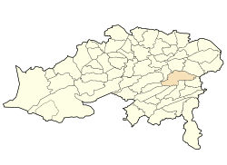
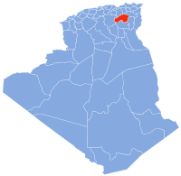
Photos • Location

35°25′N 6°23′E / 35.417°N 6.383°E
Oued Taga
وادي الطاقة ⵉⵖⵣⴻⵔ ⵏ ⵜⴰⴳⴰ | |
|---|---|
 Municipality headquarters of Oued Taga | |
 | |
| Coordinates: 35°20′N 6°14′E / 35.33°N 6.23°E | |
| Country | Algeria |
| Province | Batna |
| Time zone | UTC+1 ( West Africa Time) |
Oued Taga is a town in north-eastern Algeria.
History
|
| This section is empty. You can help by
adding to it. (June 2014) |
Geography
|
| This section is empty. You can help by
adding to it. (June 2014) |
Berbaga Cascades
The Cascades de Berbaga are located in a mountainous area difficult to reach by car in the commune of Oued Taga in the wilaya of Batna a few kilometers from Timgad]].
Population
|
| This section is empty. You can help by
adding to it. (June 2014) |
Pictures from Oued Taga
References
|
| This section is empty. You can help by
adding to it. (June 2014) |
External links
Wikimedia Commons has media related to
Oued Taga.
35°25′N 6°23′E / 35.417°N 6.383°E
Oued Taga
وادي الطاقة ⵉⵖⵣⴻⵔ ⵏ ⵜⴰⴳⴰ | |
|---|---|
 Municipality headquarters of Oued Taga | |
 | |
| Coordinates: 35°20′N 6°14′E / 35.33°N 6.23°E | |
| Country | Algeria |
| Province | Batna |
| Time zone | UTC+1 ( West Africa Time) |
Oued Taga is a town in north-eastern Algeria.
History
|
| This section is empty. You can help by
adding to it. (June 2014) |
Geography
|
| This section is empty. You can help by
adding to it. (June 2014) |
Berbaga Cascades
The Cascades de Berbaga are located in a mountainous area difficult to reach by car in the commune of Oued Taga in the wilaya of Batna a few kilometers from Timgad]].
Population
|
| This section is empty. You can help by
adding to it. (June 2014) |
Pictures from Oued Taga
References
|
| This section is empty. You can help by
adding to it. (June 2014) |
External links
Wikimedia Commons has media related to
Oued Taga.


