Oud-Alblas | |
|---|---|
Village | |
 | |
 The village centre (dark green) and the statistical district (light green) of Oud-Alblas in the former municipality of
Graafstroom. | |
| Coordinates: 51°52′N 4°42′E / 51.867°N 4.700°E | |
| Country | Netherlands |
| Province | South Holland |
| Municipality | Molenlanden |
| Area | |
| • Total | 13.1 km2 (5.1 sq mi) |
| Population (2008) | |
| • Total | 2,180 |
| • Density | 170/km2 (430/sq mi) |
| Time zone | UTC+1 ( CET) |
| • Summer ( DST) | UTC+2 ( CEST) |
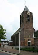
Oud-Alblas is a village in the Dutch province of South Holland. It is a part of the municipality of Molenlanden, and lies about 6 km north of Dordrecht.
In 2001, the village of Oud-Alblas had 1291 inhabitants. The built-up area of the village was 0.19 km2, and contained 455 residences. [1] The statistical area "Oud-Alblas", which also can include the peripheral parts of the village, as well as the surrounding countryside, has a population of around 2250. [2]
Oud-Alblas was a separate municipality until 1986, when it became part of Graafstroom. [3] Since 2013 Graafstroom has made part of the new municipality of Molenwaard.
-
 The river Alblas in Oud-Alblas
 -


References
- ^ Statistics Netherlands (CBS), Bevolkingskernen in Nederland 2001. (Statistics are for the continuous built-up area).
- ^ Statistics Netherlands (CBS), Statline: Kerncijfers wijken en buurten 2003-2005. As of 1 January 2005.
- ^ Ad van der Meer and Onno Boonstra, Repertorium van Nederlandse gemeenten, KNAW, 2011.
|
| This South Holland location article is a stub. You can help Wikipedia by expanding it. |
Oud-Alblas | |
|---|---|
Village | |
|
| |
|
The village centre (dark green) and the statistical district (light green) of Oud-Alblas in the former municipality of
Graafstroom. | |
| Coordinates: 51°52′N 4°42′E / 51.867°N 4.700°E | |
| Country | Netherlands |
| Province | South Holland |
| Municipality | Molenlanden |
| Area | |
| • Total | 13.1 km2 (5.1 sq mi) |
| Population (2008) | |
| • Total | 2,180 |
| • Density | 170/km2 (430/sq mi) |
| Time zone | UTC+1 ( CET) |
| • Summer ( DST) | UTC+2 ( CEST) |
Oud-Alblas is a village in the Dutch province of South Holland. It is a part of the municipality of Molenlanden, and lies about 6 km north of Dordrecht.
In 2001, the village of Oud-Alblas had 1291 inhabitants. The built-up area of the village was 0.19 km2, and contained 455 residences. [1] The statistical area "Oud-Alblas", which also can include the peripheral parts of the village, as well as the surrounding countryside, has a population of around 2250. [2]
Oud-Alblas was a separate municipality until 1986, when it became part of Graafstroom. [3] Since 2013 Graafstroom has made part of the new municipality of Molenwaard.
-
The river Alblas in Oud-Alblas
-
References
- ^ Statistics Netherlands (CBS), Bevolkingskernen in Nederland 2001. (Statistics are for the continuous built-up area).
- ^ Statistics Netherlands (CBS), Statline: Kerncijfers wijken en buurten 2003-2005. As of 1 January 2005.
- ^ Ad van der Meer and Onno Boonstra, Repertorium van Nederlandse gemeenten, KNAW, 2011.
|
| This South Holland location article is a stub. You can help Wikipedia by expanding it. |