Photos • Location

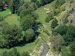
The river Ocoliș exiting the village by the same name
| Ocoliș | |
|---|---|
 | |
| Location | |
| Country | Romania |
| Counties | Alba County |
| Villages | Lunca Largă, Runc, Ocoliș |
| Physical characteristics | |
| Mouth | Arieș |
• location | Ocoliș |
• coordinates | 46°28′05″N 23°28′37″E / 46.468°N 23.477°E |
| Length | 14 km (8.7 mi) |
| Basin size | 67 km2 (26 sq mi) |
| Basin features | |
| Progression | Arieș→ Mureș→ Tisza→ Danube→ Black Sea |
| Tributaries | |
| • right | Tisa, Pociovaliștea, Craca |
The Ocoliș is a small river in the Apuseni Mountains, Alba County, western Romania. It is a left tributary of the river Arieș. [1] [2] It flows through Ocoliș commune, and joins the Arieș in the village Ocoliș. It is fed by several smaller streams, including Tisa, Pociovaliștea, and Craca. Its length is 14 km (8.7 mi) and its basin size is 67 km2 (26 sq mi). [2]
- ^ "Planul național de management. Sinteza planurilor de management la nivel de bazine/spații hidrografice, anexa 7.1" (PDF, 5.1 MB). Administrația Națională Apele Române. 2010. pp. 321–322.
- ^ a b Atlasul cadastrului apelor din România. Partea 1 (in Romanian). Bucharest: Ministerul Mediului. 1992. p. 151. OCLC 895459847. River code: IV.1.81.26

| Ocoliș | |
|---|---|
 | |
| Location | |
| Country | Romania |
| Counties | Alba County |
| Villages | Lunca Largă, Runc, Ocoliș |
| Physical characteristics | |
| Mouth | Arieș |
• location | Ocoliș |
• coordinates | 46°28′05″N 23°28′37″E / 46.468°N 23.477°E |
| Length | 14 km (8.7 mi) |
| Basin size | 67 km2 (26 sq mi) |
| Basin features | |
| Progression | Arieș→ Mureș→ Tisza→ Danube→ Black Sea |
| Tributaries | |
| • right | Tisa, Pociovaliștea, Craca |
The Ocoliș is a small river in the Apuseni Mountains, Alba County, western Romania. It is a left tributary of the river Arieș. [1] [2] It flows through Ocoliș commune, and joins the Arieș in the village Ocoliș. It is fed by several smaller streams, including Tisa, Pociovaliștea, and Craca. Its length is 14 km (8.7 mi) and its basin size is 67 km2 (26 sq mi). [2]
- ^ "Planul național de management. Sinteza planurilor de management la nivel de bazine/spații hidrografice, anexa 7.1" (PDF, 5.1 MB). Administrația Națională Apele Române. 2010. pp. 321–322.
- ^ a b Atlasul cadastrului apelor din România. Partea 1 (in Romanian). Bucharest: Ministerul Mediului. 1992. p. 151. OCLC 895459847. River code: IV.1.81.26

