Oberau | |
|---|---|
 Church of Saint Ludwig | |
 Coat of arms | |
Location of Oberau within Garmisch-Partenkirchen district 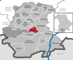 | |
 Oberau  Oberau | |
| Coordinates: 47°33′N 11°8′E / 47.550°N 11.133°E | |
| Country | Germany |
| State | Bavaria |
| Admin. region | Oberbayern |
| District | Garmisch-Partenkirchen |
| Government | |
| • Mayor (2020–26) | Peter Imminger [1] ( CSU) |
| Area | |
| • Total | 17.86 km2 (6.90 sq mi) |
| Elevation | 659 m (2,162 ft) |
| Population (2022-12-31)
[2] | |
| • Total | 3,103 |
| • Density | 170/km2 (450/sq mi) |
| Time zone | UTC+01:00 ( CET) |
| • Summer ( DST) | UTC+02:00 ( CEST) |
| Postal codes | 82496 |
| Dialling codes | 08824 |
| Vehicle registration | GAP |
| Website | www.oberau.de |
Oberau is a municipality in the district of Garmisch-Partenkirchen, in Bavaria, Germany.
Geography
Location
Oberau is located at the Loisach in the so-called "Zugspitzland". The distance between the village center and Garmisch-Partenkirchen is 8 km, whereas Oberammergau lies to the northwest (about 9 km away). The Bavarian capital Munich is 72 km away, while Innsbruck in Austrian Tyrol is 70 km away.
In addition to the parish village of Oberau, the hamlet of Buchwies, located about one kilometer east of the village, is an integral administrative part of the municipality. [3]
Transport
The district has a railway station, Oberau, on the Munich–Garmisch-Partenkirchen railway.
References
- ^ Liste der ersten Bürgermeister/Oberbürgermeister in kreisangehörigen Gemeinden, Bayerisches Landesamt für Statistik, 15 July 2021.
- ^ Genesis Online-Datenbank des Bayerischen Landesamtes für Statistik Tabelle 12411-003r Fortschreibung des Bevölkerungsstandes: Gemeinden, Stichtag (Einwohnerzahlen auf Grundlage des Zensus 2011).
- ^ "Bayerische Landesbibliothek Online (BLO)".
Towns and municipalities in
Garmisch-Partenkirchen (district) | ||
|---|---|---|
 | ||
| International | |
|---|---|
| National | |
|
| This Garmisch-Partenkirchen district location article is a stub. You can help Wikipedia by expanding it. |
Oberau | |
|---|---|
|
Church of Saint Ludwig | |
|
Coat of arms | |
Location of Oberau within Garmisch-Partenkirchen district | |
Oberau Oberau | |
| Coordinates: 47°33′N 11°8′E / 47.550°N 11.133°E | |
| Country | Germany |
| State | Bavaria |
| Admin. region | Oberbayern |
| District | Garmisch-Partenkirchen |
| Government | |
| • Mayor (2020–26) | Peter Imminger [1] ( CSU) |
| Area | |
| • Total | 17.86 km2 (6.90 sq mi) |
| Elevation | 659 m (2,162 ft) |
| Population (2022-12-31)
[2] | |
| • Total | 3,103 |
| • Density | 170/km2 (450/sq mi) |
| Time zone | UTC+01:00 ( CET) |
| • Summer ( DST) | UTC+02:00 ( CEST) |
| Postal codes | 82496 |
| Dialling codes | 08824 |
| Vehicle registration | GAP |
| Website | www.oberau.de |
Oberau is a municipality in the district of Garmisch-Partenkirchen, in Bavaria, Germany.
Geography
Location
Oberau is located at the Loisach in the so-called "Zugspitzland". The distance between the village center and Garmisch-Partenkirchen is 8 km, whereas Oberammergau lies to the northwest (about 9 km away). The Bavarian capital Munich is 72 km away, while Innsbruck in Austrian Tyrol is 70 km away.
In addition to the parish village of Oberau, the hamlet of Buchwies, located about one kilometer east of the village, is an integral administrative part of the municipality. [3]
Transport
The district has a railway station, Oberau, on the Munich–Garmisch-Partenkirchen railway.
References
- ^ Liste der ersten Bürgermeister/Oberbürgermeister in kreisangehörigen Gemeinden, Bayerisches Landesamt für Statistik, 15 July 2021.
- ^ Genesis Online-Datenbank des Bayerischen Landesamtes für Statistik Tabelle 12411-003r Fortschreibung des Bevölkerungsstandes: Gemeinden, Stichtag (Einwohnerzahlen auf Grundlage des Zensus 2011).
- ^ "Bayerische Landesbibliothek Online (BLO)".
Towns and municipalities in
Garmisch-Partenkirchen (district) | ||
|---|---|---|
| ||
| International | |
|---|---|
| National | |
|
| This Garmisch-Partenkirchen district location article is a stub. You can help Wikipedia by expanding it. |