Photos • Location
Obannapalem | |
|---|---|
Village | |
 Obannapalem | |
|
Dynamic map | |
| Coordinates: 15°30′N 80°03′E / 15.5°N 80.05°E | |
| Country | India |
| State | Andhra Pradesh |
| Region | Coastal Andhra |
| District | Prakasam |
| Languages | |
| • Official | Telugu |
| Time zone | UTC+5:30 ( IST) |
| PIN | 523183 |
| Telephone code | (+91)8592 |
| Lok Sabha constituency | Bapatla |
| Assembly constituency | Santhanuthalapadu |
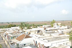
Obannapalem is a village in Naguluppalapadu Mandal in Prakasam District of Andhra Pradesh State, India. It belongs to Andhra region.
Obannapalem | |
|---|---|
Village | |
 Obannapalem | |
|
Dynamic map | |
| Coordinates: 15°30′N 80°03′E / 15.5°N 80.05°E | |
| Country | India |
| State | Andhra Pradesh |
| Region | Coastal Andhra |
| District | Prakasam |
| Languages | |
| • Official | Telugu |
| Time zone | UTC+5:30 ( IST) |
| PIN | 523183 |
| Telephone code | (+91)8592 |
| Lok Sabha constituency | Bapatla |
| Assembly constituency | Santhanuthalapadu |
Obannapalem is a village in Naguluppalapadu Mandal in Prakasam District of Andhra Pradesh State, India. It belongs to Andhra region.
