Nuba | |
|---|---|
| Arabic transcription(s) | |
| • Arabic | نوبا |
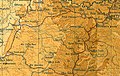
 Nuba Location of Nuba within
Palestine | |
| Coordinates: 31°36′26″N 35°02′12″E / 31.60722°N 35.03667°E | |
| Palestine grid | 153/112 |
| State | State of Palestine |
| Governorate | Hebron |
| Government | |
| • Type | Municipality |
| Population (2017)
[1] | |
| • Total | 5,631 |
| Name meaning | probably meaning "a top" [2] |
Nuba ( Arabic: نوبا) is a Palestinian village located eleven kilometers north-west of Hebron.The village is in the Hebron Governorate of the State of Palestine, in the southern West Bank. According to the Palestinian Central Bureau of Statistics, the village had a population of 5,631 in 2017. [1]
The village is mentioned in a late 14th-century document of the Mamluk Sultanate, which ruled Palestine from Cairo, where three villagers are named as "al'ru'asā [ lit. 'the leaders'] in the village of Nūbā". [3]
Nuba, like the rest of Palestine, was incorporated into the Ottoman Empire in 1516, and in a tax register from 1596, the village was listed as part of the nahiya (sbdistrict) of Hebron in the Liwa of Jerusalem. It had a population of 82 Muslim households. The villagers paid a fixed tax rate of 25% on wheat, barley, vineyards and fruit trees, occasional revenues, goats and/or beehives; a total of 10,000 akçe. [4]
In 1838, the biblical scholar Edward Robinson noted Nuba as a Muslim village between the mountains and Gaza, and administratively attached to Hebron. [5] It was one of a cluster of villages at the foot of a mountain, together with Kharas and Beit Ula. [6] An Ottoman village list from c. 1870 showed that Nuba had 52 houses and a population of 200, though the population count only included men. [7] [8] In 1883, PEF's Survey of Western Palestine described Nuba as a "small village perched on a low hill, with a well about a mile to the east." [9] In 1896 the population of Nuba was estimated to be about 537. [10]
In the 1922 census of Palestine conducted by the British Mandate authorities, Nuba' had a population 357, all Muslims. [11] This had increased at the time of the 1931 census to 611 Muslims, living in 140 houses. [12] In the 1945 statistics the population of Nuba was 760, all Muslims, [13] who owned 22,836 dunams of land according to an official land and population survey. [14] 403 dunams were plantations and irrigable land, 10,116 for cereals, [15] while 33 dunams were built-up (urban) land. [16]
-
 Nuba, British Mandate map, 1:20,000
 -
 Nuba 1945 1:250,000


In the wake of the 1948 Arab–Israeli War, and after the 1949 Armistice Agreements, Nuba came under Jordanian rule. The Jordanian census of 1961 found 1,075 inhabitants in Nuba. [17]
Since the Six-Day War in 1967, Nuba has been under Israeli occupation.
- Abdulrahim Abu-Husayn, a Palestinian historian.
- ^ a b Preliminary Results of the Population, Housing and Establishments Census, 2017 (PDF). Palestinian Central Bureau of Statistics (PCBS) (Report). State of Palestine. February 2018. pp. 64–82. Retrieved 2023-10-24.
- ^ Palmer, 1881, p. 405
- ^ Singer, 1994, p. 36
- ^ Hütteroth and Abdulfattah, 1977, p. 124
- ^ Robinson and Smith, 1841, vol 3, Appendix 2, p. 117
- ^ Robinson and Smith, 1841, vol 2, p. 426
- ^ Socin, 1879, p. 158 It was noted in the district of Hebron
- ^ Hartmann, 1883, p. 143, noted 51 houses
- ^ Conder and Kitchener, 1883, SWP III, p. 309
- ^ Schick, 1896, p. 123
- ^ Barron, 1923, Table V, Sub-district of Hebron, p. 10. But see talk.
- ^ Mills, 1932, p. 33
- ^ Government of Palestine, Department of Statistics, 1945, p. 23
- ^ Government of Palestine, Department of Statistics. Village Statistics, April, 1945. Quoted in Hadawi, 1970, p. 50
- ^ Government of Palestine, Department of Statistics. Village Statistics, April, 1945. Quoted in Hadawi, 1970, p. 93
- ^ Government of Palestine, Department of Statistics. Village Statistics, April, 1945. Quoted in Hadawi, 1970, p. 143
- ^ Government of Jordan, Department of Statistics, 1964, p. 23
- Barron, J. B., ed. (1923). Palestine: Report and General Abstracts of the Census of 1922. Government of Palestine.
- Conder, C.R.; Kitchener, H.H. (1883). The Survey of Western Palestine: Memoirs of the Topography, Orography, Hydrography, and Archaeology. Vol. 3. London: Committee of the Palestine Exploration Fund.
- Government of Jordan, Department of Statistics (1964). First Census of Population and Housing. Volume I: Final Tables; General Characteristics of the Population (PDF).
- Government of Palestine, Department of Statistics (1945). Village Statistics, April, 1945.
- Hadawi, S. (1970). Village Statistics of 1945: A Classification of Land and Area ownership in Palestine. Palestine Liberation Organization Research Center.
- Hartmann, M. (1883). "Die Ortschaftenliste des Liwa Jerusalem in dem türkischen Staatskalender für Syrien auf das Jahr 1288 der Flucht (1871)". Zeitschrift des Deutschen Palästina-Vereins. 6: 102–149.
- Hütteroth, Wolf-Dieter; Abdulfattah, Kamal (1977). Historical Geography of Palestine, Transjordan and Southern Syria in the Late 16th Century. Erlanger Geographische Arbeiten, Sonderband 5. Erlangen, Germany: Vorstand der Fränkischen Geographischen Gesellschaft. ISBN 3-920405-41-2.
- Mills, E., ed. (1932). Census of Palestine 1931. Population of Villages, Towns and Administrative Areas. Jerusalem: Government of Palestine.
- Palmer, E.H. (1881). The Survey of Western Palestine: Arabic and English Name Lists Collected During the Survey by Lieutenants Conder and Kitchener, R. E. Transliterated and Explained by E.H. Palmer. Committee of the Palestine Exploration Fund.
- Robinson, E.; Smith, E. (1841). Biblical Researches in Palestine, Mount Sinai and Arabia Petraea: A Journal of Travels in the year 1838. Vol. 2. Boston: Crocker & Brewster.
- Robinson, E.; Smith, E. (1841). Biblical Researches in Palestine, Mount Sinai and Arabia Petraea: A Journal of Travels in the year 1838. Vol. 3. Boston: Crocker & Brewster.
- Schick, C. (1896). "Zur Einwohnerzahl des Bezirks Jerusalem". Zeitschrift des Deutschen Palästina-Vereins. 19: 120–127.
- Singer, A. (1994). Palestinian peasants and Ottoman officials: rural administration around sixteenth-century Jerusalem (3rd, illustrated ed.). Cambridge University Press. ISBN 0-521-47679-8.
- Socin, A. (1879). "Alphabetisches Verzeichniss von Ortschaften des Paschalik Jerusalem". Zeitschrift des Deutschen Palästina-Vereins. 2: 135–163.
- Welcome To The City of Nuba
- Nuba, Welcome to Palestine
- Survey of Western Palestine, Map 21: IAA, Wikimedia commons
- Nuba Village (Fact Sheet), Applied Research Institute–Jerusalem (ARIJ)
- Nuba Village Profile, ARIJ
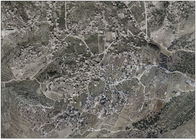
- Nuba aerial photo, ARIJ
- The priorities and needs for development in Nuba village based on the community and local authorities’ assessment, ARIJ

| Authority control databases: National |
|---|
Nuba | |
|---|---|
| Arabic transcription(s) | |
| • Arabic | نوبا |
Nuba Location of Nuba within
Palestine | |
| Coordinates: 31°36′26″N 35°02′12″E / 31.60722°N 35.03667°E | |
| Palestine grid | 153/112 |
| State | State of Palestine |
| Governorate | Hebron |
| Government | |
| • Type | Municipality |
| Population (2017)
[1] | |
| • Total | 5,631 |
| Name meaning | probably meaning "a top" [2] |
Nuba ( Arabic: نوبا) is a Palestinian village located eleven kilometers north-west of Hebron.The village is in the Hebron Governorate of the State of Palestine, in the southern West Bank. According to the Palestinian Central Bureau of Statistics, the village had a population of 5,631 in 2017. [1]
The village is mentioned in a late 14th-century document of the Mamluk Sultanate, which ruled Palestine from Cairo, where three villagers are named as "al'ru'asā [ lit. 'the leaders'] in the village of Nūbā". [3]
Nuba, like the rest of Palestine, was incorporated into the Ottoman Empire in 1516, and in a tax register from 1596, the village was listed as part of the nahiya (sbdistrict) of Hebron in the Liwa of Jerusalem. It had a population of 82 Muslim households. The villagers paid a fixed tax rate of 25% on wheat, barley, vineyards and fruit trees, occasional revenues, goats and/or beehives; a total of 10,000 akçe. [4]
In 1838, the biblical scholar Edward Robinson noted Nuba as a Muslim village between the mountains and Gaza, and administratively attached to Hebron. [5] It was one of a cluster of villages at the foot of a mountain, together with Kharas and Beit Ula. [6] An Ottoman village list from c. 1870 showed that Nuba had 52 houses and a population of 200, though the population count only included men. [7] [8] In 1883, PEF's Survey of Western Palestine described Nuba as a "small village perched on a low hill, with a well about a mile to the east." [9] In 1896 the population of Nuba was estimated to be about 537. [10]
In the 1922 census of Palestine conducted by the British Mandate authorities, Nuba' had a population 357, all Muslims. [11] This had increased at the time of the 1931 census to 611 Muslims, living in 140 houses. [12] In the 1945 statistics the population of Nuba was 760, all Muslims, [13] who owned 22,836 dunams of land according to an official land and population survey. [14] 403 dunams were plantations and irrigable land, 10,116 for cereals, [15] while 33 dunams were built-up (urban) land. [16]
-
Nuba, British Mandate map, 1:20,000
-
Nuba 1945 1:250,000
In the wake of the 1948 Arab–Israeli War, and after the 1949 Armistice Agreements, Nuba came under Jordanian rule. The Jordanian census of 1961 found 1,075 inhabitants in Nuba. [17]
Since the Six-Day War in 1967, Nuba has been under Israeli occupation.
- Abdulrahim Abu-Husayn, a Palestinian historian.
- ^ a b Preliminary Results of the Population, Housing and Establishments Census, 2017 (PDF). Palestinian Central Bureau of Statistics (PCBS) (Report). State of Palestine. February 2018. pp. 64–82. Retrieved 2023-10-24.
- ^ Palmer, 1881, p. 405
- ^ Singer, 1994, p. 36
- ^ Hütteroth and Abdulfattah, 1977, p. 124
- ^ Robinson and Smith, 1841, vol 3, Appendix 2, p. 117
- ^ Robinson and Smith, 1841, vol 2, p. 426
- ^ Socin, 1879, p. 158 It was noted in the district of Hebron
- ^ Hartmann, 1883, p. 143, noted 51 houses
- ^ Conder and Kitchener, 1883, SWP III, p. 309
- ^ Schick, 1896, p. 123
- ^ Barron, 1923, Table V, Sub-district of Hebron, p. 10. But see talk.
- ^ Mills, 1932, p. 33
- ^ Government of Palestine, Department of Statistics, 1945, p. 23
- ^ Government of Palestine, Department of Statistics. Village Statistics, April, 1945. Quoted in Hadawi, 1970, p. 50
- ^ Government of Palestine, Department of Statistics. Village Statistics, April, 1945. Quoted in Hadawi, 1970, p. 93
- ^ Government of Palestine, Department of Statistics. Village Statistics, April, 1945. Quoted in Hadawi, 1970, p. 143
- ^ Government of Jordan, Department of Statistics, 1964, p. 23
- Barron, J. B., ed. (1923). Palestine: Report and General Abstracts of the Census of 1922. Government of Palestine.
- Conder, C.R.; Kitchener, H.H. (1883). The Survey of Western Palestine: Memoirs of the Topography, Orography, Hydrography, and Archaeology. Vol. 3. London: Committee of the Palestine Exploration Fund.
- Government of Jordan, Department of Statistics (1964). First Census of Population and Housing. Volume I: Final Tables; General Characteristics of the Population (PDF).
- Government of Palestine, Department of Statistics (1945). Village Statistics, April, 1945.
- Hadawi, S. (1970). Village Statistics of 1945: A Classification of Land and Area ownership in Palestine. Palestine Liberation Organization Research Center.
- Hartmann, M. (1883). "Die Ortschaftenliste des Liwa Jerusalem in dem türkischen Staatskalender für Syrien auf das Jahr 1288 der Flucht (1871)". Zeitschrift des Deutschen Palästina-Vereins. 6: 102–149.
- Hütteroth, Wolf-Dieter; Abdulfattah, Kamal (1977). Historical Geography of Palestine, Transjordan and Southern Syria in the Late 16th Century. Erlanger Geographische Arbeiten, Sonderband 5. Erlangen, Germany: Vorstand der Fränkischen Geographischen Gesellschaft. ISBN 3-920405-41-2.
- Mills, E., ed. (1932). Census of Palestine 1931. Population of Villages, Towns and Administrative Areas. Jerusalem: Government of Palestine.
- Palmer, E.H. (1881). The Survey of Western Palestine: Arabic and English Name Lists Collected During the Survey by Lieutenants Conder and Kitchener, R. E. Transliterated and Explained by E.H. Palmer. Committee of the Palestine Exploration Fund.
- Robinson, E.; Smith, E. (1841). Biblical Researches in Palestine, Mount Sinai and Arabia Petraea: A Journal of Travels in the year 1838. Vol. 2. Boston: Crocker & Brewster.
- Robinson, E.; Smith, E. (1841). Biblical Researches in Palestine, Mount Sinai and Arabia Petraea: A Journal of Travels in the year 1838. Vol. 3. Boston: Crocker & Brewster.
- Schick, C. (1896). "Zur Einwohnerzahl des Bezirks Jerusalem". Zeitschrift des Deutschen Palästina-Vereins. 19: 120–127.
- Singer, A. (1994). Palestinian peasants and Ottoman officials: rural administration around sixteenth-century Jerusalem (3rd, illustrated ed.). Cambridge University Press. ISBN 0-521-47679-8.
- Socin, A. (1879). "Alphabetisches Verzeichniss von Ortschaften des Paschalik Jerusalem". Zeitschrift des Deutschen Palästina-Vereins. 2: 135–163.
- Welcome To The City of Nuba
- Nuba, Welcome to Palestine
- Survey of Western Palestine, Map 21: IAA, Wikimedia commons
- Nuba Village (Fact Sheet), Applied Research Institute–Jerusalem (ARIJ)
- Nuba Village Profile, ARIJ
- Nuba aerial photo, ARIJ
- The priorities and needs for development in Nuba village based on the community and local authorities’ assessment, ARIJ
| Authority control databases: National |
|---|