| Native name | Bóthar Northumberland ( Irish) |
|---|---|
| Former name(s) | Blenheim Street |
| Namesake | Hugh Percy, 3rd Duke of Northumberland |
| Length | 650 m (2,130 ft) |
| Width | 19 metres (62 ft) |
| Location | Ballsbridge, Dublin, Ireland |
| Postal code | D04 |
| Coordinates | 53°20′09″N 6°14′16″W / 53.335832°N 6.237878°W |
| north end | Mount Street Lower |
| south end | Pembroke Street |
| Other | |
| Known for | embassies |
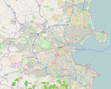
Northumberland Road ( Irish: Bóthar Northumberland) [1] is a Victorian street in Ballsbridge, Dublin, the capital of the Republic of Ireland.
The street was named after Hugh Percy, 3rd Duke of Northumberland in 1844, and built on the site of the earlier Blenheim Street. [2] The property on both sides of the road was developed into residential houses at the turn of the 20th century by Reginald Herbert, 15th Earl of Pembroke.
What is considered to be one of the biggest battles of the Easter Uprising occurred at 25 Northumberland Road. [3] [4] [5] According to The Irish Times, at 4:45PM on Day One, "The elderly, unarmed Veteran Defence Force march into a rebel ambush on Northumberland Road". [6]
References
- ^ "Bóthar Northumberland". logainm.ie.
- ^ Christopher Teeling M'Cready (1892). Dublin Street Names, Dated and Explained. Harvard University: Hodges. p. 74.
- ^ "Dublin still bears the scars of the 1916 Easter Rising battle almost 100 years later". IrishCentral. 1 April 2021.
- ^ The Battle of Mount Street Bridge 1916
- ^ "Diarmuid Gavin Episode - 1916 The Battle of Mount Street". RTÉ One. Archived from the original on 30 January 2010.
- ^ Murphy, Darragh (23 September 2015). "A blow-by-blow guide to the Easter Rising". The Irish Times.

